Travel Guide
Places to Visit in Nagar Valley: Rakaposhi, Hopar Glacier and Rush Lake
Nagar is the Gilgit-Baltistan valley on the other bank of the Hunza River: Rakaposhi, Hopar Glacier, Rush Lake and the road to Hispar.
Nagar Valley is in the Hunza-Nagar region of Gilgit-Baltistan, in Pakistan's far north, on the south bank of the Hunza River facing Hunza. It is not Naggar in Himachal, India, which shares almost the same name. Anyone driving the Karakoram Highway from Gilgit to Karimabad passes through Nagar first, and Rakaposhi stands over the road for much of the drive.
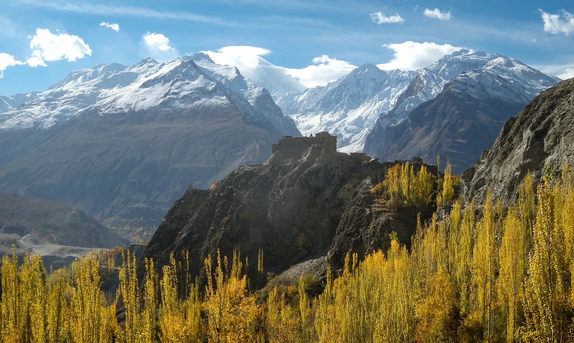
Nagar draws visitors for the mountains around it. From different points in the valley you can see four peaks over 7,000 m: Rakaposhi, Diran and Golden Peak on the Nagar side, and Ultar Sar across the river in Hunza. The valley is known for its fruit, its terraced fields and the way its colours change with the seasons.
- Where
- South bank of the Hunza River, facing Hunza
- Biggest peak
- Rakaposhi, 7,788 m
- Rush Lake
- 4,694 m, 5 to 7 days from Hopar
- From Gilgit
- About 100 km to Nagar Khas
On this page
- 01Where is Nagar Valley?
- 02Places to visit in Nagar Valley
- 03Rush Lake trek
- 04Rush Lake trek itinerary: 7 days from Karimabad
- 05Is the Rush Lake trek hard? Season, permits and gear
- 06How to reach Nagar Valley from Lahore and Islamabad
- 07Best time to visit Nagar Valley
- 08Nagar and Hunza on one trip
- 09Frequently asked questions
Where is Nagar Valley?
Nagar is its own district of Gilgit-Baltistan, the Nagar District, on the south and east bank of the Hunza River. Hunza is on the other bank. Nagar was once a princely state ruled by its Mirs, with the same status and importance as Hunza. The British took control after the Hunza-Nagar campaign of 1891, and the state was dissolved in 1974.
The valley spreads over a wide area, but its main village, Nagar Khas, sits just opposite Karimabad across the river. Chalt, Bar, Jafarabad, Nilt, Thol, Ghulmet, Pissan and Minapin lie along or near the Karakoram Highway. Nagar Khas, Sikandarabad, Hopar, Hispar and Sumayar are further up the side valleys.
People in Nagar speak Burushaski and Shina, roughly split by village, while English and Urdu are widely used with visitors. Ghulmet in Nagar is not the same place as Gulmit in Upper Hunza, which has the museum, so check the spelling when you plan.
Places to visit in Nagar Valley
Nagar's sights fall into two groups. Ghulmet, Minapin, Chalt and Nilt are on the Karakoram Highway, so you pass them on the drive to Hunza anyway. Hopar and Hispar are up the side road from Nagar Khas and need a day set aside.
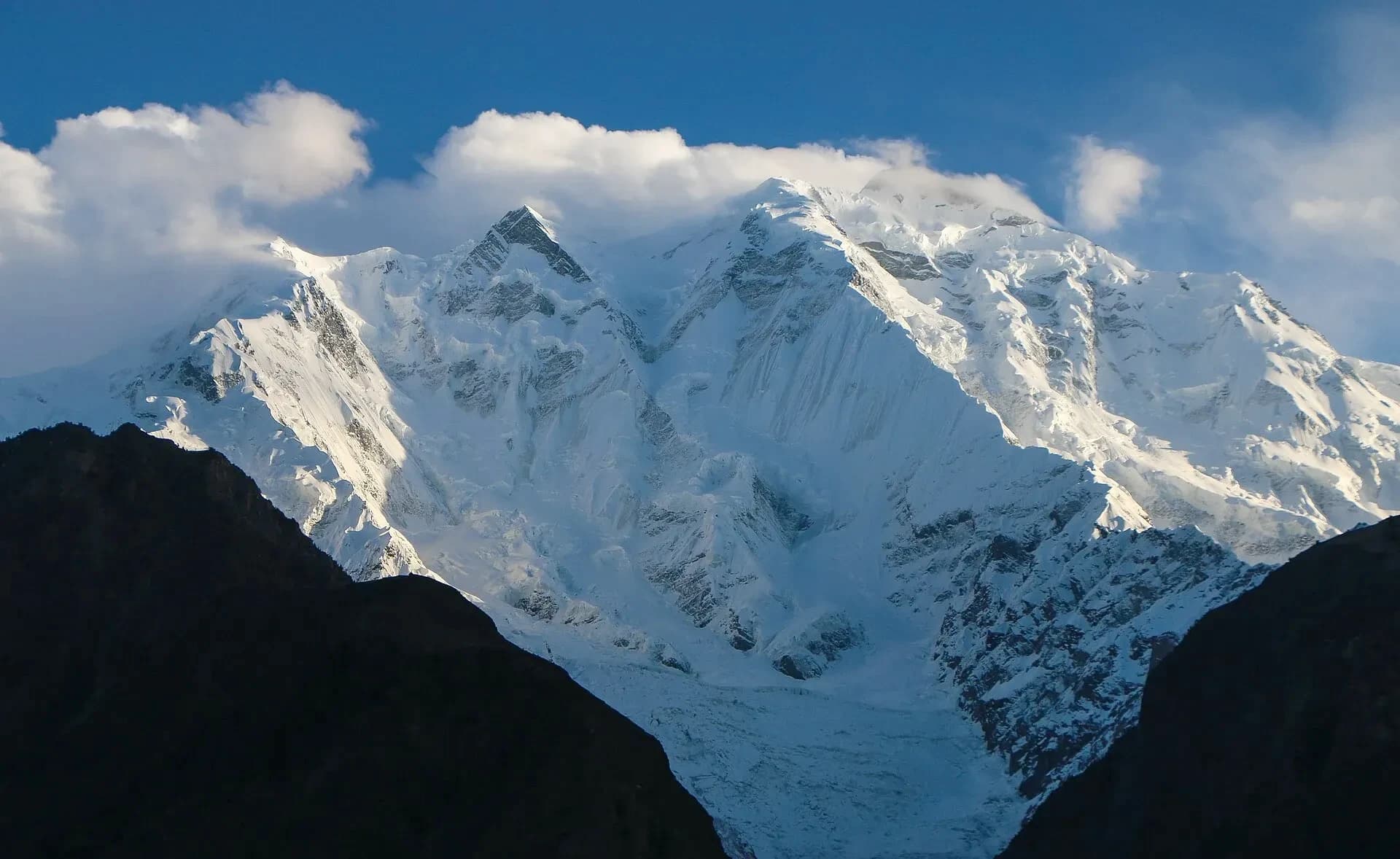
Rakaposhi and the Ghulmet viewpoint
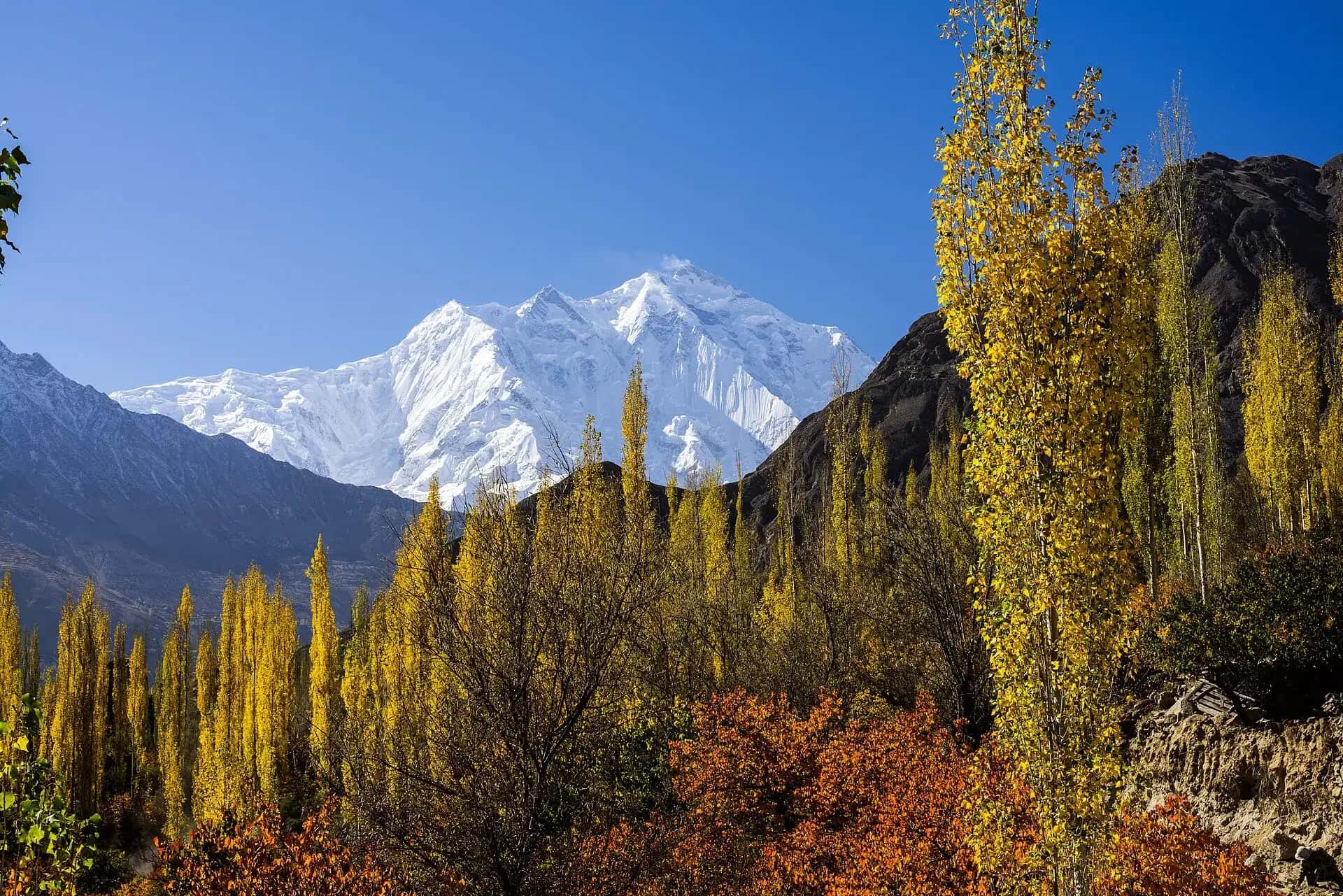
Rakaposhi (7,788 m) is a Karakoram peak about 100 km north of Gilgit, standing between Nagar on one side and the Bagrote and Danyore valleys on the other. It ranks 27th in the world, but it is more popular for its beauty than its rank might suggest, because the snow face climbs almost straight up from the valley floor. The name is often translated as "shining wall". Local people also call it Dumani, mother of mist.
Mike Banks and Tom Patey of a British expedition made the first ascent on 25 June 1958, by the Southwest Spur, and both came down with minor frostbite. Nobody stood on the top again until 1979.
From the road, the closest view is at Ghulmet, about 75 km from Gilgit on the KKH, where a row of cafes faces the mountain across a glacier stream. Our 6 day standard tour books its three Nagar nights at a hotel near this viewpoint, so you see the face at dawn and at dusk.
Minapin and the Rakaposhi base camp hike
Minapin village, just off the highway, is the start of the walk to Rakaposhi base camp at Tagaphari. The trail climbs through fields and pine to Hapakun (about 2,900 m), then up the moraine of the Minapin Glacier to Tagaphari (about 3,300 to 3,500 m; sources differ). Fit walkers do it as a long return day of 6 to 7 hours, but a night at the camp is easier and gives you the evening light on Rakaposhi and Diran.
There are crevasses on the Minapin Glacier, so go with a local guide rather than on your own.
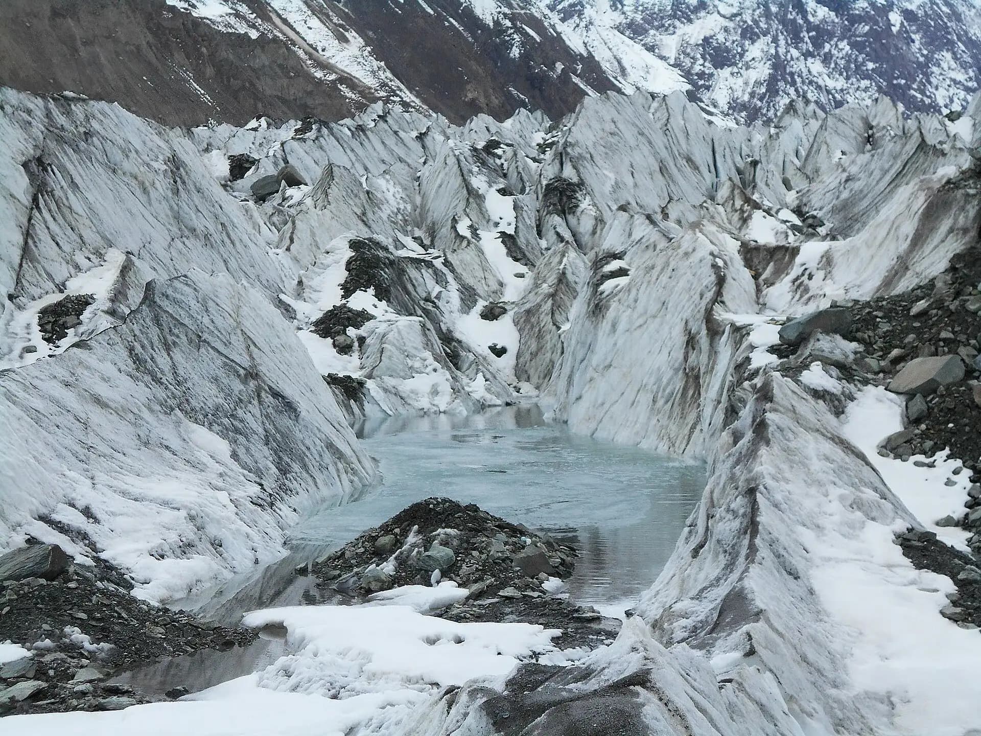
Hopar (Hopper) Glacier
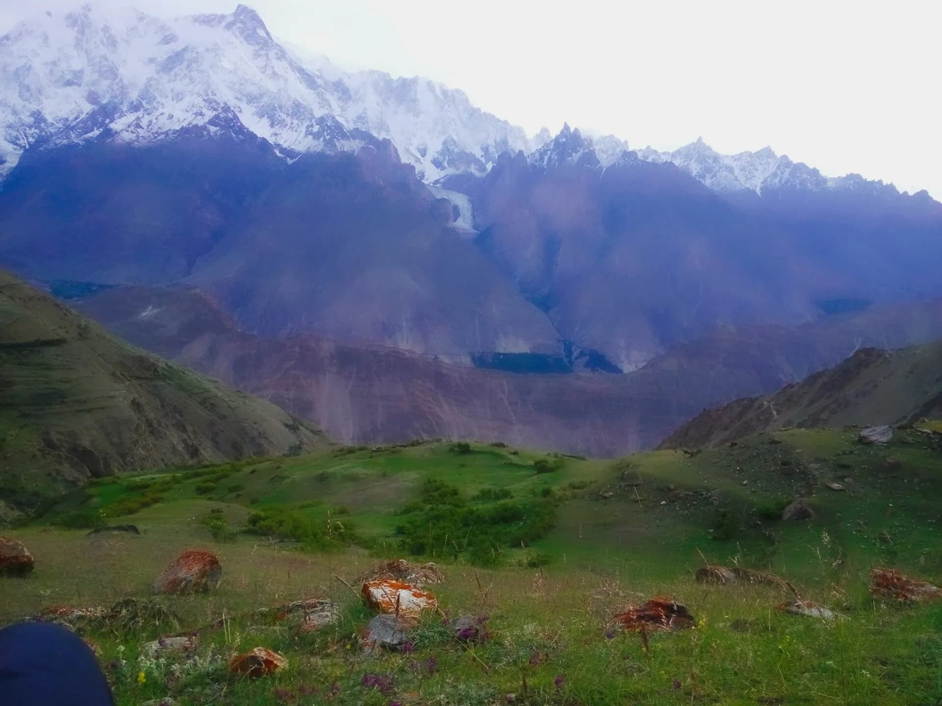
Hopar, also spelled Hopper, is a group of villages about 10 km beyond Nagar Khas. They sit around a natural bowl at a bend of the Bualtar Glacier, which most visitors call the Hopper glacier. Opposite Hopar, the white Bualtar is joined by the Barpu Glacier, and the Miar Glacier is close by. Hopar is the base camp for treks into the high, ice-covered peaks of the Hispar Muztagh, including Rush Lake.
The road from Karimabad crosses the river and climbs through Nagar Khas; allow about 1 to 1.5 hours by jeep or car. There is a glacier viewpoint near the village, and a path goes down onto the ice. The walk down and back takes about 1.5 hours each way, so give Hopar half a day. Everyone in this valley speaks Burushaski, a language with no known relatives that has long puzzled linguists.
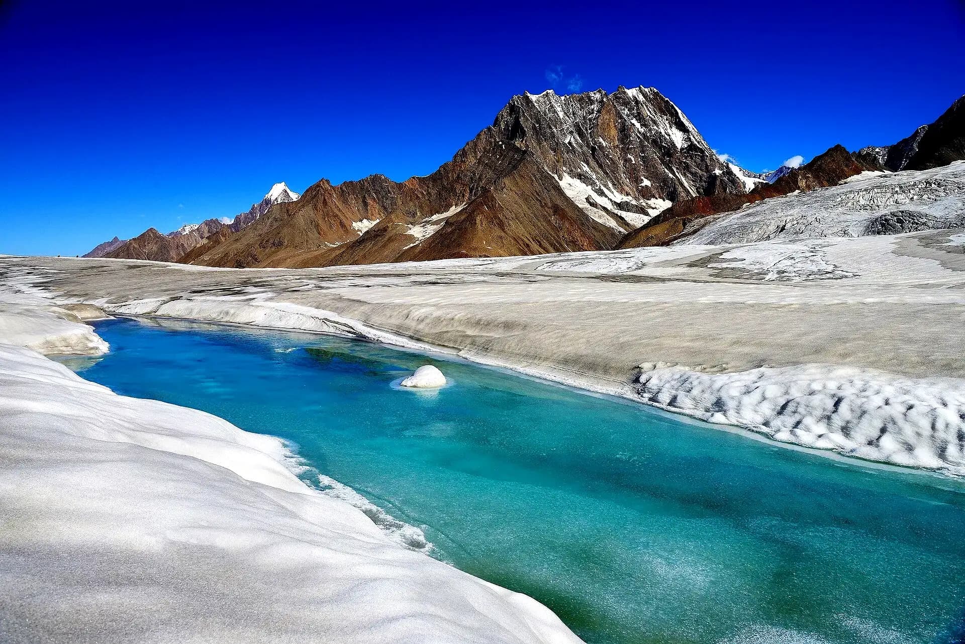
Hispar Valley and Hispar Glacier
Hispar is the last village up a jeep road about 28 km from Nagar Khas. Hispar Glacier, 49 km long, is one of the big glaciers of the Karakoram and fills the valley above the village.
At its head is the Hispar La pass and Snow Lake, where the Hispar meets the Biafo Glacier coming up from Baltistan. Trekkers who cross from Askole come down the Hispar to Hispar village at the end of the Snow Lake trek.
Diran
Diran (7,266 m) stands between the Rakaposhi and Haramosh massifs, east of Rakaposhi, above the Minapin Glacier. From the Nagar side it looks like an easy snow dome, and that look has fooled people: it has a name for sudden snowstorms and avalanches. A British team tried it in 1958, a German one in 1959 and an Austrian one in 1964, and all turned back. Three Austrians, Rainer Goeschl, Rudolph Pischinger and Hanns Schell, finally made the first ascent in 1968, climbing alpine style. The best view is from Tagaphari, the Rakaposhi base camp above Minapin.
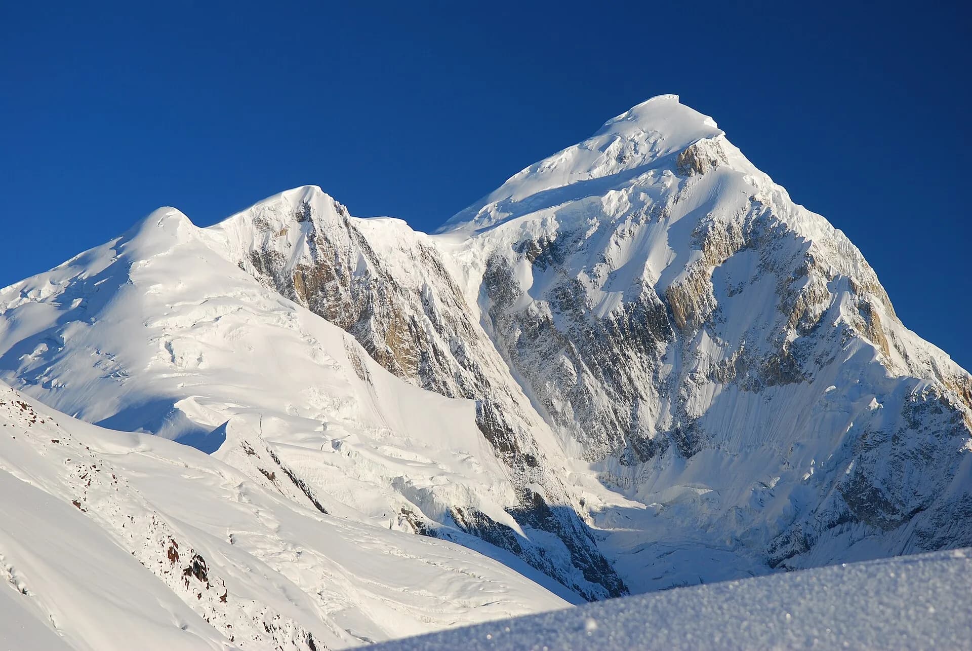
Golden Peak (Spantik)
Spantik (7,027 m) is better known as Golden Peak, after the colour its rock face takes in evening light. It rises at the head of the glaciers above Hopar, and you can pick it out from Karimabad and Eagle's Nest. Rush Lake lies about 15 km to its north, and from the lake the peak is in full view.
Bar Valley, Chalt and Nilt
Chalt is the first part of Nagar you reach coming up the KKH from Gilgit, and the village where Bedeski, a language of its own, is still spoken. Bar Valley branches off above it, with a jeep road past Budalas and the Bar villages towards the glacier and summer pastures. It sees a fraction of the visitors Hopar gets.
Nilt, a little further up the highway, is where British troops fought the men of Hunza and Nagar at Nilt Fort in December 1891. After it, both states accepted British control. Near the Nagar turn-off opposite Karimabad, where the Hunza and Nagar rivers meet, there are old rock carvings on the boulders.
Rush Lake trek
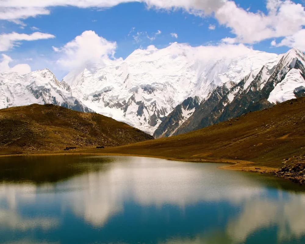
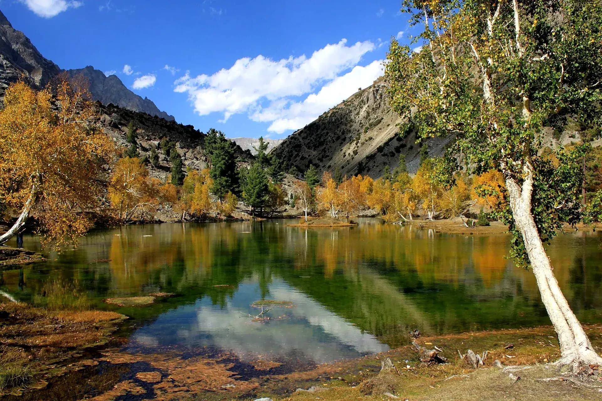
Rush Lake is a high-altitude lake in Nagar at 4,694 m, below Rush Peak (about 5,098 m). It is one of the highest alpine lakes in the world and lies about 15 km north of Miar Peak and Spantik. You reach it from Nagar and Hopar, along the Bualtar (Hopar) Glacier and the Miar Glacier, which comes down from Miar and Phuparash peaks.
The trek gives some of the finest mountain views in the Karakoram: Spantik, Malubiting, Miar Peak, Phuparash Peak and Ultar Sar. The route crosses glaciers, meadows and the terraced fields of the Karakoram before you come to the lake, with clear water, slopes full of wildflowers in summer and peaks over 7,000 m all round. In winter the lake freezes and the whole area turns white.
Rush Lake trek itinerary: 7 days from Karimabad
Camp names change from one outfit to the next. Many groups now stop at Bericho Kor (about 3,300 m) and Chidin Harai (about 4,440 m), and some come back down by Phahi Phari and Hamdar, but the days work out much the same as below.
| Day | Route | What to expect |
|---|---|---|
| 1 | Karimabad to Hopar | Drive from Karimabad to Hopar. |
| 2 | Hopar to Shishkin | A hot walk, so keep your water bottles full. Cross the Hopar Glacier, then follow the lateral moraine for about an hour to Shishkin. |
| 3 | Shishkin to Barpu Giram | A stony, hot gully leads to the Barpu Glacier. Crossing it is a bit steep and takes one to two hours. |
| 4 | Barpu Giram to Rush Lake | An easy zigzag path. From the top you see high peaks such as Lupghar Sar and Momhil Sar. |
| 5 | Rest day at Rush Lake | Free day. Climb Rush Peak for views of the Hispar gorge and a full circle of Golden Peak, Miar, Ultar and the Passu peaks, all of Nagar and the mountains north of Hispar. Steep, but not a technical climb. |
| 6 | Rush Lake to Gutens | 3 to 4 hours of walking. |
| 7 | Gutens to Hopar | 4 to 5 hours down to Hopar, then jeeps back to Hunza. |
Is the Rush Lake trek hard? Season, permits and gear
You need no ropes or climbing skills, but you do need legs. The glacier crossings on days 2 and 3 are rough going over loose rock, and the night at the lake is at 4,694 m. We would call it moderate to hard, and not a first trek: do a few days of hill walking at home before you try it.
- The route is open from late June to early September. Outside that, snow covers the upper trail.
- Trekkers in 2025 reported that no permit is needed, as Rush Lake is in the open zone. Rules change, so check before you go.
- There are no huts or shops. Carry tents, a stove and food, or go with a local operator and porters from Hopar.
- Sleep at least two nights at the middle camps before the night at the lake, to give your body time with the height.
- From Lahore, set aside 12 to 14 days in all: two days of road each way, the trek itself and a couple of spare days for weather.
How to reach Nagar Valley from Lahore and Islamabad
Gilgit is about 845 km from Lahore by road, which is two days with a night on the way, and about 490 km from Islamabad. From Gilgit the KKH enters Nagar at Chalt, and Ghulmet and the Rakaposhi viewpoint are about 75 km from Gilgit. Karimabad and the Nagar Khas turn-off are about 100 km from Gilgit, 2 to 2.5 hours by road. Flights from Islamabad to Gilgit save a day but are often cancelled in bad weather.
Our 6 day Hunza group tour sleeps three nights in Nagar. Departures are at 11 pm by Toyota Coaster, from Thokar Niaz Baig or Barkat Market in Lahore, with a pickup for Islamabad guests on the way. See the Hunza tour packages and the wider Gilgit-Baltistan tour packages for dates and days. Hopar, Bar or the Rakaposhi base camp hike need extra time, so we plan those as private trips with your own car and driver on request.
Best time to visit Nagar Valley
The highway through Nagar stays open in winter. The side roads to Hopar and Hispar can close after snow, and the trekking routes are under it until summer.
| Months | What Nagar is like | Good for |
|---|---|---|
| April | Apricot and cherry blossom in the villages | Sightseeing on the KKH and Hopar |
| May to June | Green fields, snow still on high trails | Hopar, Minapin, Bar Valley |
| Late June to early September | Warm days, high passes open | Rush Lake trek, Rakaposhi base camp, Hispar |
| Mid October to early November | Poplars and fields turn yellow and red | Autumn photos, Hopar, the KKH |
| December to March | Cold, side roads can close with snow | KKH sightseeing only |
Nagar and Hunza on one trip
Nagar and Hunza face each other across one river, and it would be odd to see one without the other. A good split is a night or two on the Nagar side for Rakaposhi and Hopar, then the bridge to Karimabad for the forts, Attabad Lake and the Khunjerab Pass. For the Hunza bank, see our list of places to visit in Hunza.
Frequently asked questions
Where is Nagar Valley, and is it part of Hunza?
Nagar Valley is in Gilgit-Baltistan, Pakistan, on the south bank of the Hunza River opposite Hunza. It is a separate district, Nagar District, though people often say Hunza-Nagar for the two together. It is not Naggar in Himachal, India.
What are the best places to visit in Nagar Valley?
The Rakaposhi viewpoint at Ghulmet, Hopar Glacier, the Rakaposhi base camp hike from Minapin, Hispar Valley, Bar Valley and, for trekkers, Rush Lake. Diran and Golden Peak are in view from several of these.
How far is Hopar (Hopper) Glacier from Karimabad, and can you walk on it?
Hopar is about 10 km past Nagar Khas, so 1 to 1.5 hours by car or jeep from Karimabad. You can walk down onto it: the path from the viewpoint reaches the moraine in about 1.5 hours, and the climb back takes as long. Beyond the beaten path the ice has crevasses, so take a guide from the village if you want to go further.
How high is Rush Lake, and how many days does the trek take?
The lake is at 4,694 m, and Rush Peak above it about 5,098 m. Most groups take 5 to 7 days from Hopar and back. Counting the road from Lahore, plan on 12 to 14 days.
Is the Rush Lake trek hard? Do I need a permit or a guide?
It is a moderate to hard trek with glacier crossings and nights above 4,000 m, but no technical climbing. Recent reports say no permit is needed. There are no lodges, so you need tents and food or a local operator with porters.
Show 3 more questions
Where is the best Rakaposhi viewpoint?
For a roadside view, Ghulmet, on the Karakoram Highway about 75 km from Gilgit. Karimabad and Eagle's Nest also face it. To get right under the face, walk up from Minapin to Tagaphari, the base camp, in a long day or with one night out.
When is the best time to go to Nagar?
April for blossom, May to October for sightseeing, late June to early September for treks such as Rush Lake, and mid October to early November for autumn colour. In winter, stick to the KKH stops.
What language is spoken in Nagar?
Burushaski and Shina, depending on the village, and Bedeski in Chalt. Hopar, Nagar Khas and the upper valleys speak Burushaski. Anyone who deals with visitors speaks Urdu, and many speak some English.