Travel Guide
20 Places to Visit in Hunza Valley, from Karimabad to Khunjerab
Twenty places to visit in Hunza, grouped the way the valley is laid out: central Hunza around Karimabad, Nagar across the river, and upper Hunza up to the Khunjerab Pass.
The places to visit in Hunza sit along about 200 km of the Karakoram Highway, from the Rakaposhi viewpoint in the south to the Khunjerab Pass on the Chinese border. Hunza is probably Pakistan's most visited valley: a small world of villages and orchards surrounded by rugged, snow-capped mountains, about 100 km from Gilgit. It is the first main town on the highway if you enter Pakistan from China.
Hunza has lakes, high peaks and white glaciers within a day's drive of each other. In autumn the poplars turn yellow, and in winter a sheet of snow covers the whole valley. Karimabad, the main town, is at about 2,500 m.
Locals split Hunza into three: lower Hunza (Shinaki) towards Gilgit, central Hunza around Karimabad and Aliabad, and upper Hunza, called Gojal, from Attabad Lake to the border. Most sights are in the central and upper parts. Two of the best, the Rakaposhi viewpoint and Hopar Glacier, are across the river in Nagar, which was a separate state, and most Hunza trips take them in. All times below are by car from Karimabad.
- Main town
- Karimabad, about 2,500 m
- From Lahore
- About 930 km, 2 days by road
- Best months
- April to October
- Highest stop
- Khunjerab Pass, 4,693 m
On this page
- 01Central Hunza: Karimabad and around
- 02Across the river: Nagar
- 03Upper Hunza (Gojal): Attabad Lake to the Chinese border
- 04Peaks you can see from Hunza
- 05Glaciers of Hunza and Nagar
- 06Hunza culture, people and festivals
- 07Fruits and food of Hunza
- 08Distances and times from Karimabad
- 09Best time to visit Hunza
- 10How to reach Hunza from Lahore and Islamabad
- 11How many days do you need in Hunza?
- 12Before you go: signal, cash, altitude and tickets
- 13Frequently asked questions
Central Hunza: Karimabad and around
Most visitors sleep in or near Karimabad, and everything in this part is within 20 minutes of the bazaar by car, or on foot from it.
 01
Karimabad
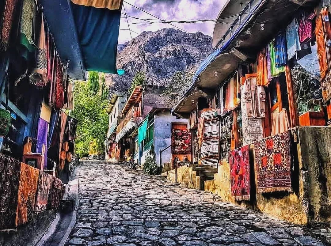
Karimabad is the capital of Hunza and its most popular stop. Baltit is its old name, and people still use it. The town is named after Prince Karim Aga Khan, the late spiritual head of the Ismaili community. In 2000 Baltit Fort and Karimabad village won the British Airways Tourism for Tomorrow award, and The Guardian later listed Karimabad among the five best places to visit in Pakistan.
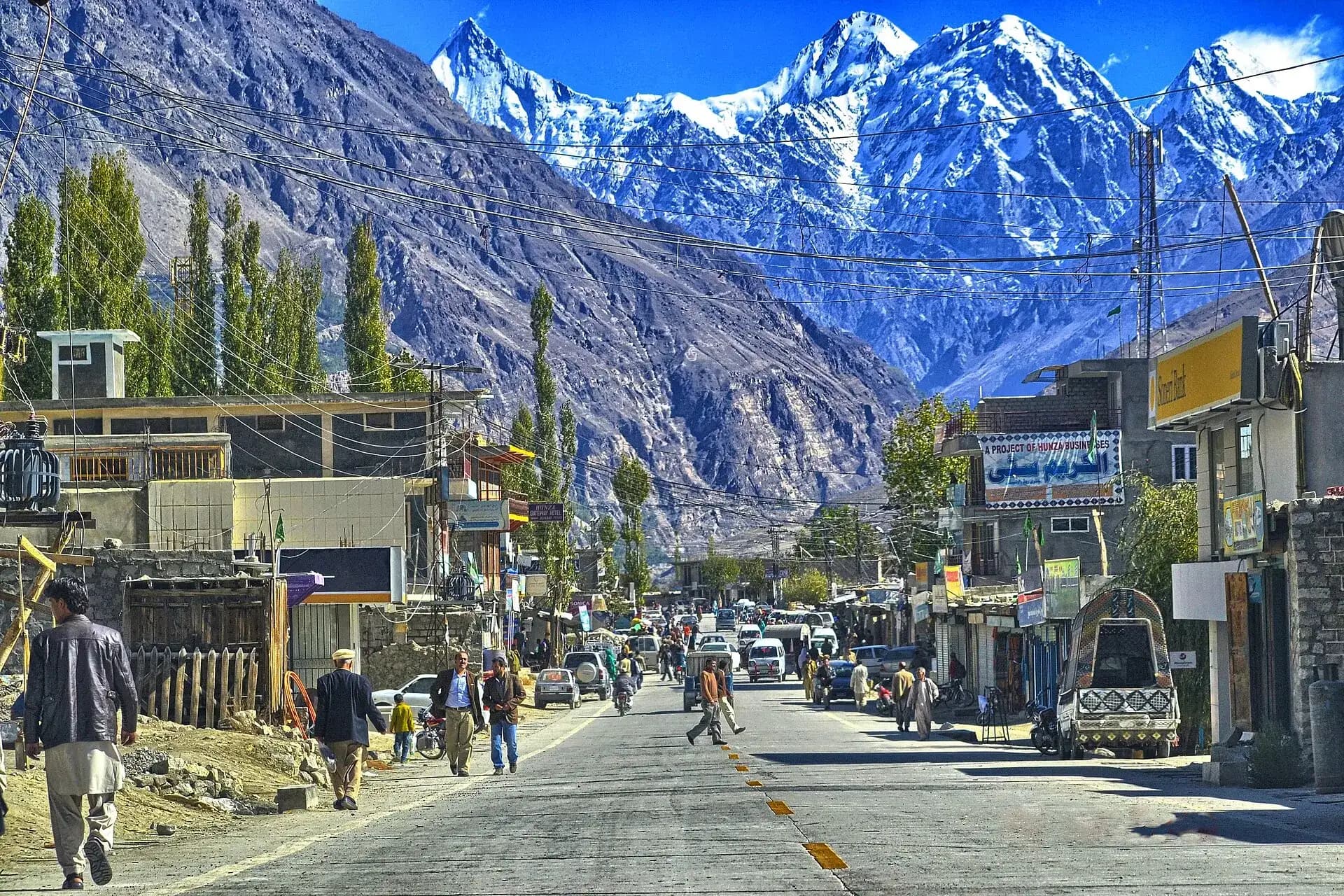
The bazaar runs down the hill below the fort, with shops for dried apricots, walnuts, gems, carpets and the woollen Hunza cap. Evenings are the best time to walk it, when the light goes off Rakaposhi across the valley.
 02
Baltit Fort
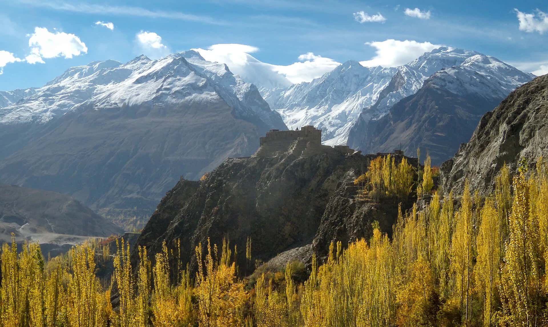
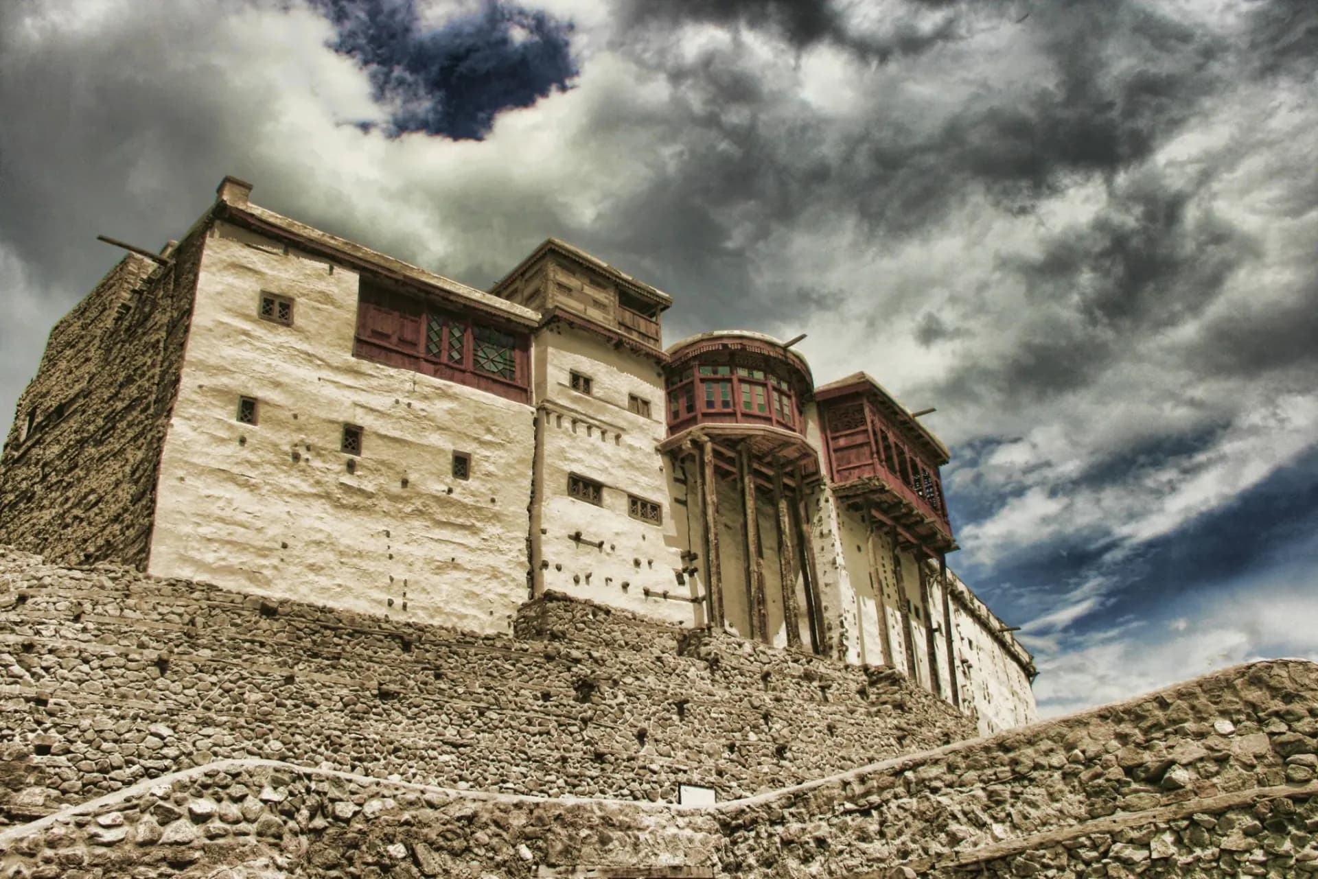
Baltit Fort stands on top of Karimabad and is more than 700 years old. For centuries it was the seat of the Mirs, the rulers of Hunza. The royal family lived in Altit Fort before moving here, and the last Mir moved out in 1945.
Empty, the fort slowly fell apart. The Aga Khan Trust for Culture restored it to its original look, and it opened as a museum in 1996. Today it is a symbol of the region's history and one of the main sights in Gilgit-Baltistan. You go round with a guide, who comes with the ticket at the gate: in 2025 it was about PKR 1,000 for Pakistanis and PKR 1,200 for foreigners.
 03
Altit Fort
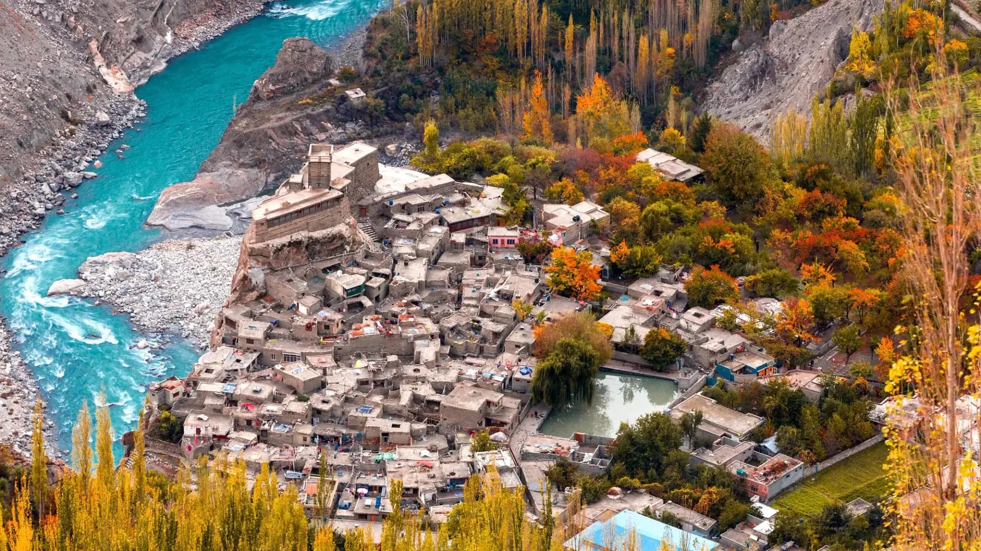
Altit Fort is the oldest fort in the northern areas, built in the 11th century on a rock above the Hunza River at the foot of the valley, about 3 km from Karimabad. It is considered the birthplace of the Hunza state and its first capital. The fort has survived attacks and several earthquakes, which says a lot about how its builders worked.
In its early days traders on the Silk Route between China and the south stopped here, and Altit became a meeting place for the region. The Aga Khan Trust for Culture restored it in the 2000s, it has been open to visitors since 2007, and in 2011 the work won a UNESCO Asia-Pacific heritage award. Next to the fort is the old royal garden, with a cafe where most people sit down for apricot juice and walnut cake after the tour. The guided tour cost about PKR 1,600 per person in 2025 for visitors from outside Gilgit-Baltistan, Pakistani or foreign; local residents pay much less.
 04
Eagle's Nest (Duikar)
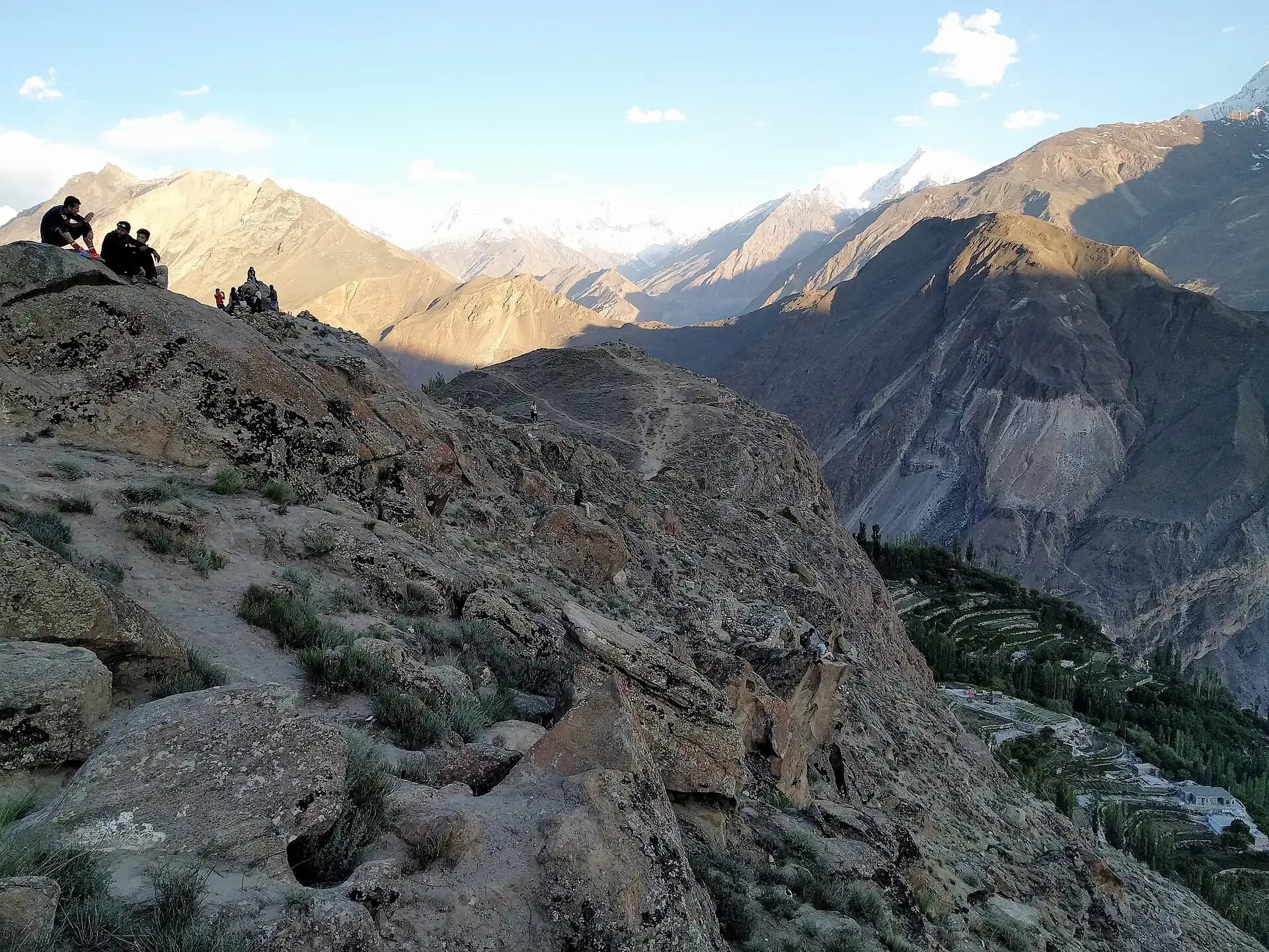
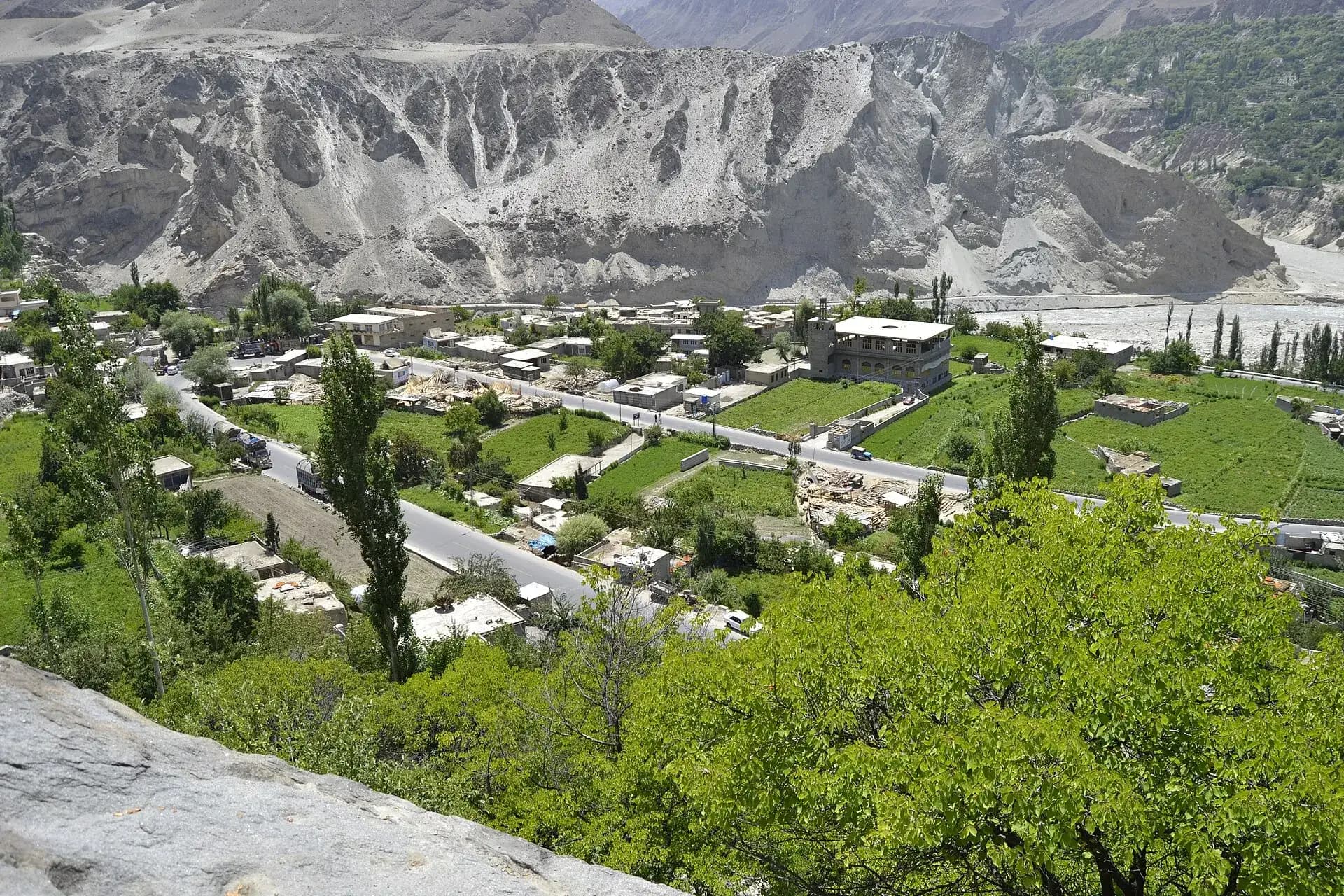
Eagle's Nest is the rocky top above Duikar village, roughly 3,000 m up and about 6 km from Karimabad by a narrow road with tight bends. No other spot near town shows you so many peaks at once. Rakaposhi, Diran, Golden Peak, Ladyfinger and Ultar all stand around you, and central Hunza and Nagar lie spread out on both sides of the river below.
Go up for sunrise, or an hour before sunset, and take a jacket, because it is windy and much colder than the bazaar. In dry weather an ordinary car can do the road. If it has rained or snowed, hire a local jeep.
 05
Ganish village
Ganish sits on the highway just below Karimabad, and most people drive past it without stopping. The old village behind it has watchtowers, old wooden mosques and narrow lanes between stone houses. The Aga Khan Trust for Culture restored it, and the work won UNESCO Asia-Pacific heritage awards in 2002, for four of the mosques, and in 2009. Local guides show visitors round for a small fee.
The Sacred Rocks of Hunza
Near Ganish, at a place locals call Haldeikish, a pile of boulders beside the road is covered in old rock carvings and inscriptions, scratched by people travelling the route long before the highway. Many drivers do not know it by name, so ask for the Sacred Rocks. It is an easy stop on the way to Attabad Lake.
 07
Ultar Meadows
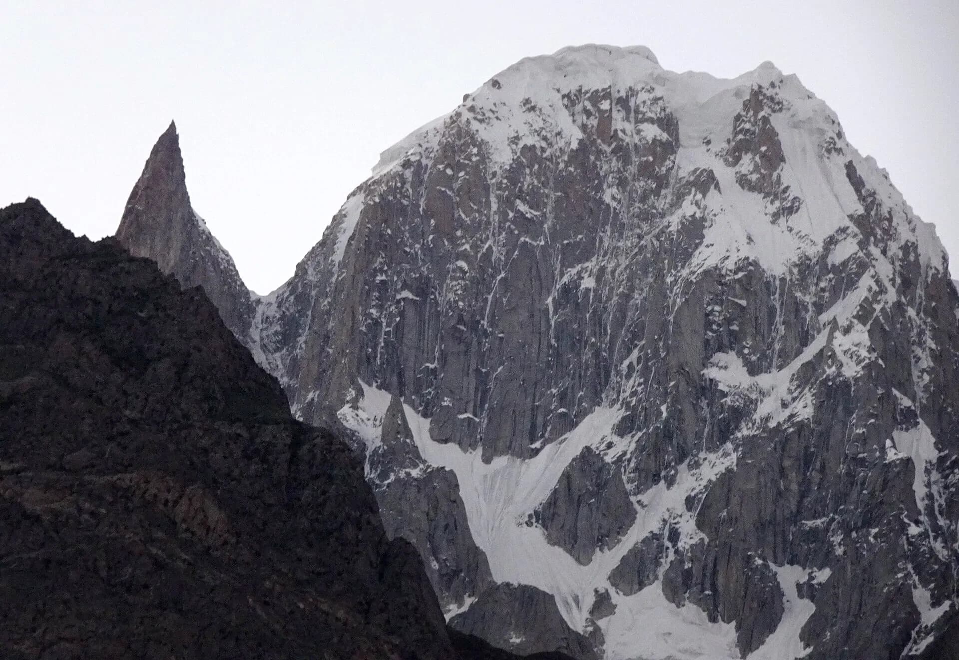
Behind Baltit Fort a path follows the irrigation channel up the Ultar gorge to the meadows below Ultar Sar (7,388 m) and Ladyfinger Peak. It is the one real hike you can start from your hotel door in Karimabad. The path is steep and loose in places, so start early, take water and snacks, and turn back by early afternoon. A local guide is worth it if you have not walked in the Karakoram before.
 08
Aliabad
Aliabad, about 7 km west of Karimabad on the highway, is Hunza's main market town. It is not pretty, but it is where you go for banks, ATMs, a SIM card or a tyre repair. Many hotels and guest houses line the road here, and Rakaposhi faces you across the river.
Across the river: Nagar
Nagar was a state of equal standing with Hunza, on the opposite bank of the Hunza River, and its main village is just across from Karimabad. Rush Lake, Hispar and the other side valleys are in our Nagar Valley guide.
 09
Rakaposhi View Point
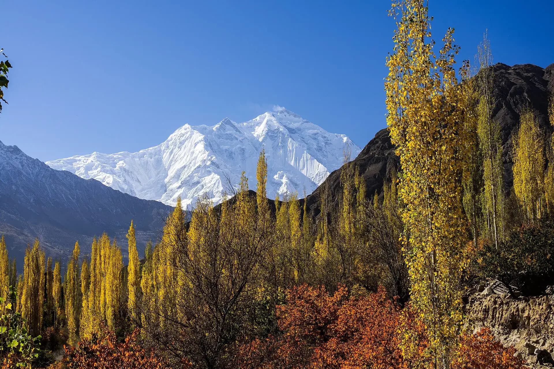
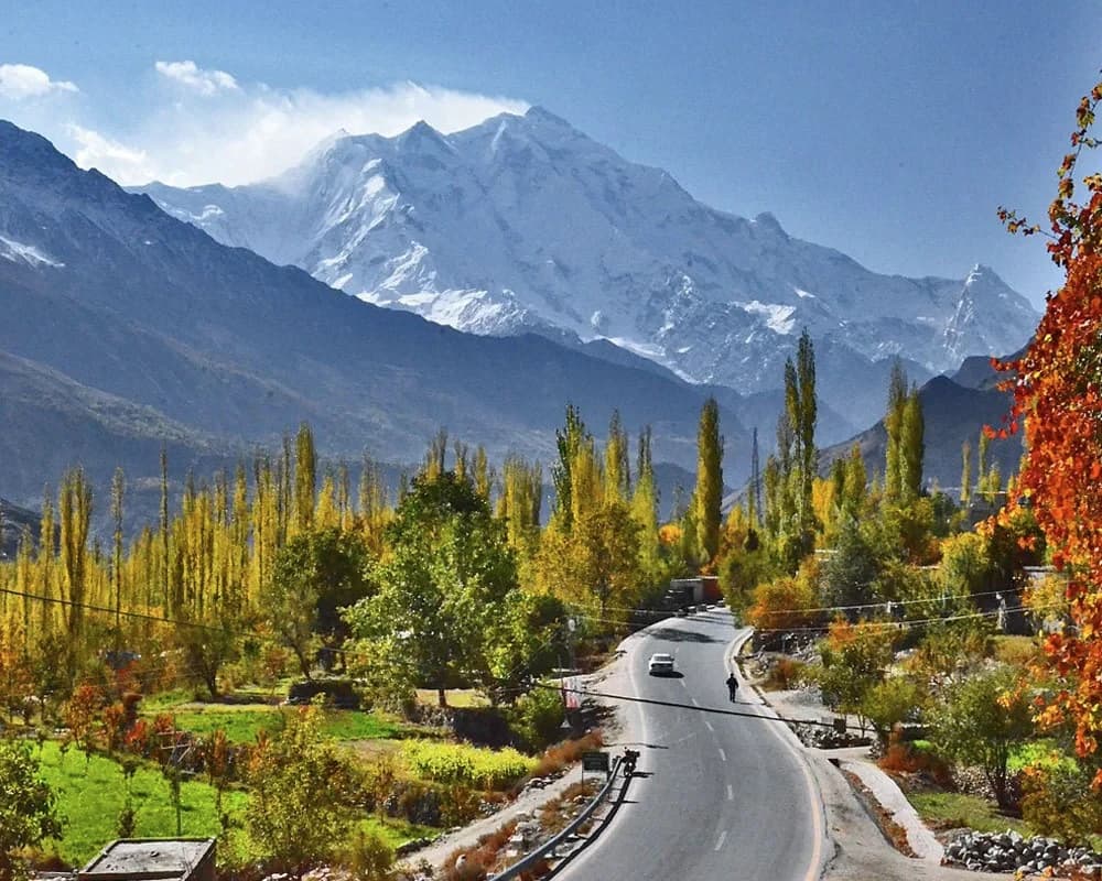
You reach this stop before Karimabad, at Ghulmet in Nagar, so it is the first big view of the trip. Rakaposhi (7,788 m) stands right over the road here: from the Hunza River to its summit is a climb of about 5,900 m in just over 11 km of horizontal distance. A glacier stream runs past the tea stalls, and coasters pull in for tea and photos. Its local name, Dumani, means mother of mist, so if the summit is clear when you pass, stop then rather than on the way home.
 10
Hopar Glacier
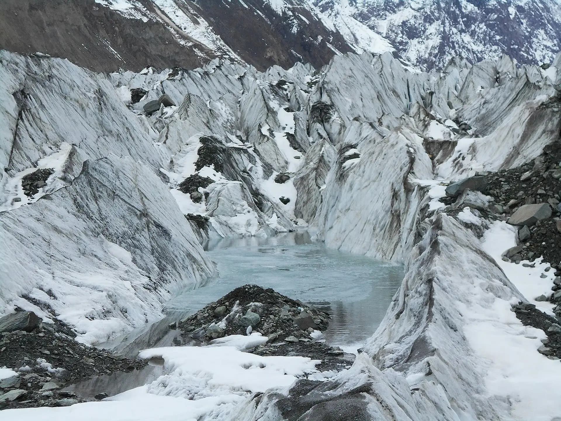
Hopar is the easiest glacier to reach from Karimabad: cross the river, drive up through Nagar Khas, and in about an hour the road ends at a cluster of villages on the edge of the Bualtar, or Hopar, Glacier. The ice is grey with rock and cracked into crevasses, and a path drops from the viewpoint onto the moraine. The drive and the viewpoint fill a morning; walking down onto the ice and back adds about three hours. Trekkers bound for Rush Lake start here.
Upper Hunza (Gojal): Attabad Lake to the Chinese border
North of Karimabad the valley narrows, the orchards thin out and the language changes from Burushaski to Wakhi. Most visitors see this stretch in one long day, with Khunjerab at the far end, and wish they had given it two.
 11
Attabad Lake
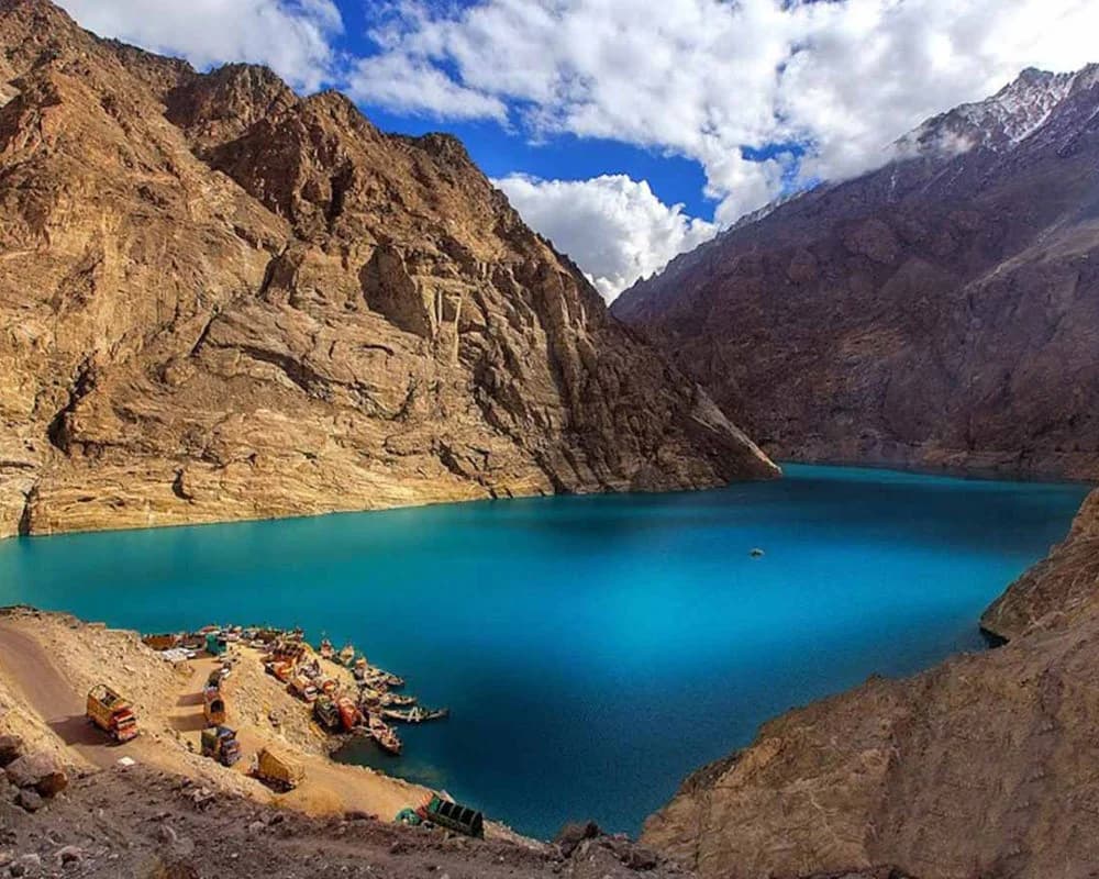
On 4 January 2010 a massive landslide at Attabad village blocked the narrow Hunza valley and its river, about 14 km upstream of Karimabad. Twenty people died and thousands were cut off. The water backed up into a lake about 21 km long and up to 109 m deep, and more than 19 km of the Karakoram Highway disappeared under it. For five years the only way north was to cross the lake by boat to Hussaini and rejoin the highway there.
Now the lake is a tourist spot, 30 to 40 minutes from Karimabad, used for boating, jet skis and fishing. Boats are hired per boat, not per person, and a group of six or seven sharing one pays far less each than a couple. Agree the price and the length of the ride before you get in.
The Pakistan-China Friendship Tunnels
Five tunnels, about 7 km in all, carry the Karakoram Highway past Attabad Lake on a new 24 km road built by Pakistan and China and opened in September 2015. Before them there was no road here at all, and goods from China went across the lake on boats. They were built for the trade route down to Gwadar, but every car going to upper Hunza now uses them too.
 13
Gulmit
Gulmit is the biggest village in Gojal. The highway runs through it after the upper end of Attabad Lake, roughly an hour out of Karimabad. In a traditional house there is a small local museum with old maps, utensils, musical instruments and a stuffed snow leopard. Gulmit is also the best base for a night in upper Hunza, with Hussaini, Borith Lake and Passu close by.
 14
Hussaini Suspension Bridge
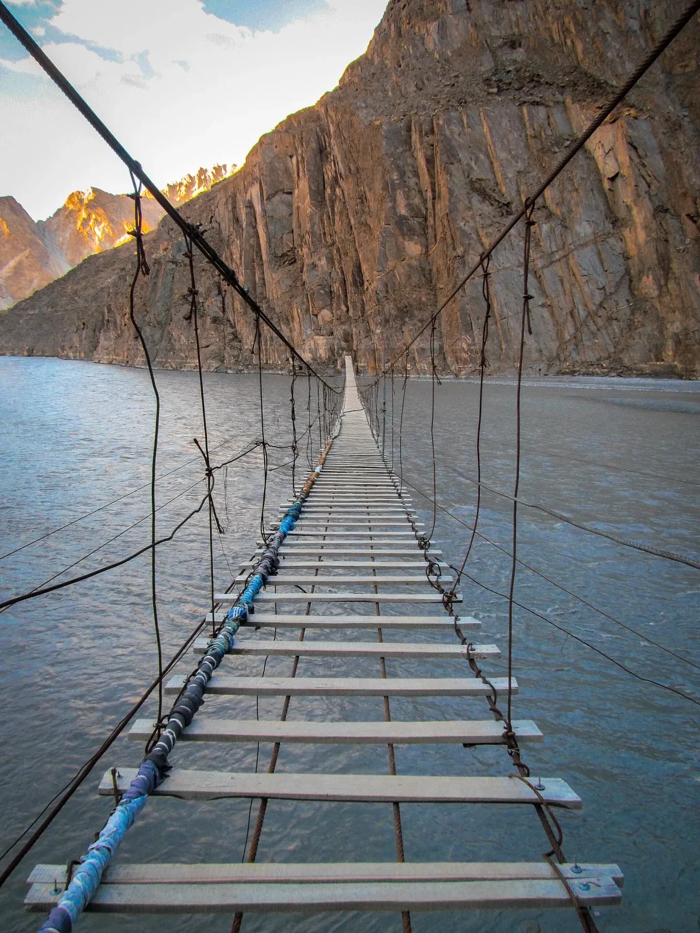
The Hussaini bridge hangs about 194 m across the Hunza River from Hussaini to Zarabad, on the far bank. It is a line of loose wooden planks on steel cables, and the gaps between the planks are wide enough to see the water through. Villagers built the first one around 1968 and have rebuilt it after floods since. A small fee is collected at the Hussaini end. Hold the side cables, keep small children off it, and expect it to swing once you are halfway.
 15
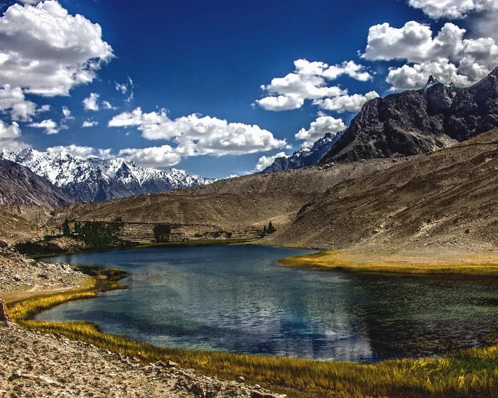
Borith Lake
Borith is a small lake at about 2,600 m, on a shelf above Hussaini. By car it is a short drive up a 2 km road; on foot it is a two to three hour walk from Gulmit over the snout of the Ghulkin Glacier. Birdwatchers come in spring (March to June) and autumn (September to November), when ducks on migration rest on the water. Few day-trippers have time for it, which is the main reason to stay a night up here.
 16
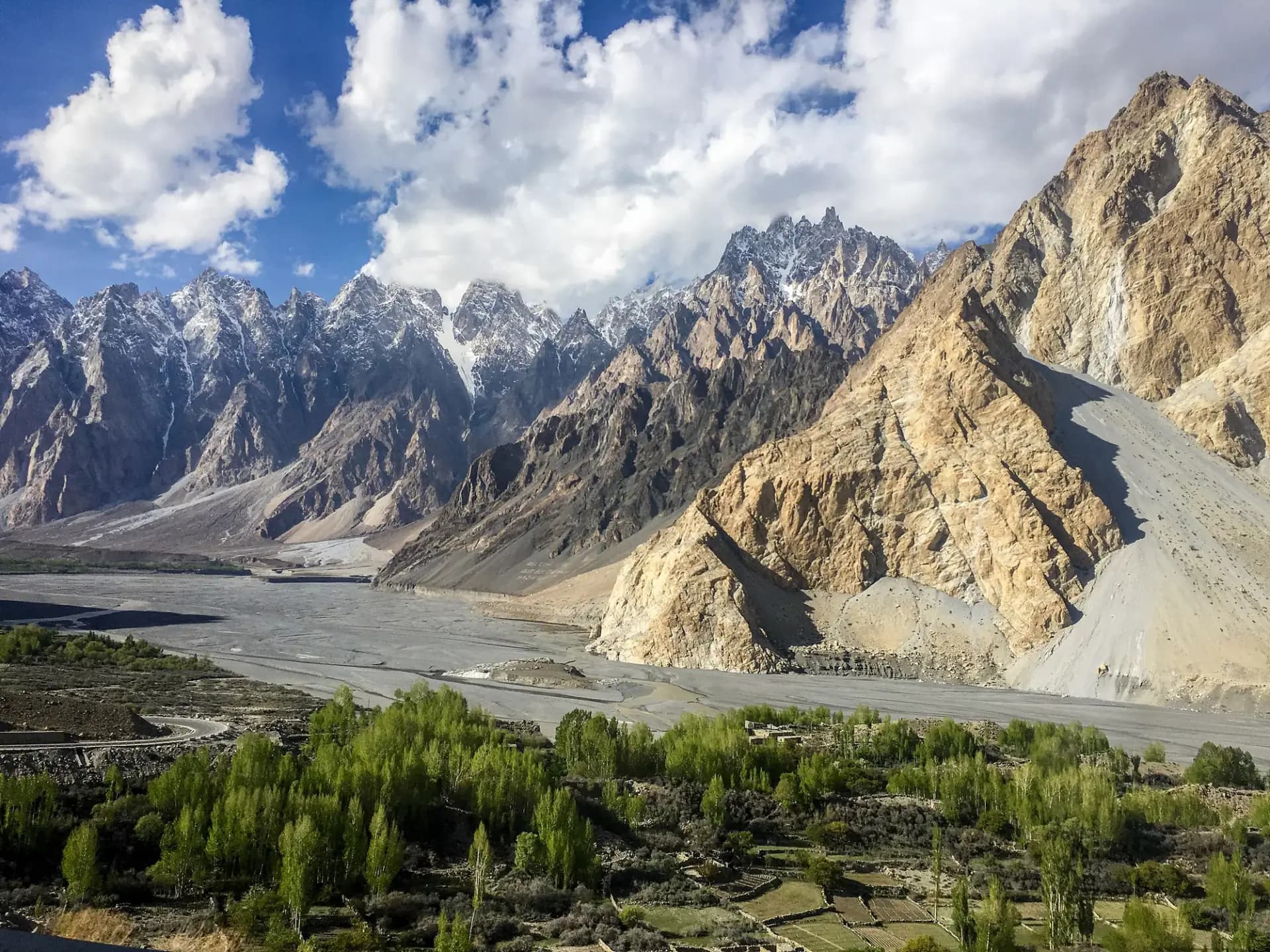
Passu Cones
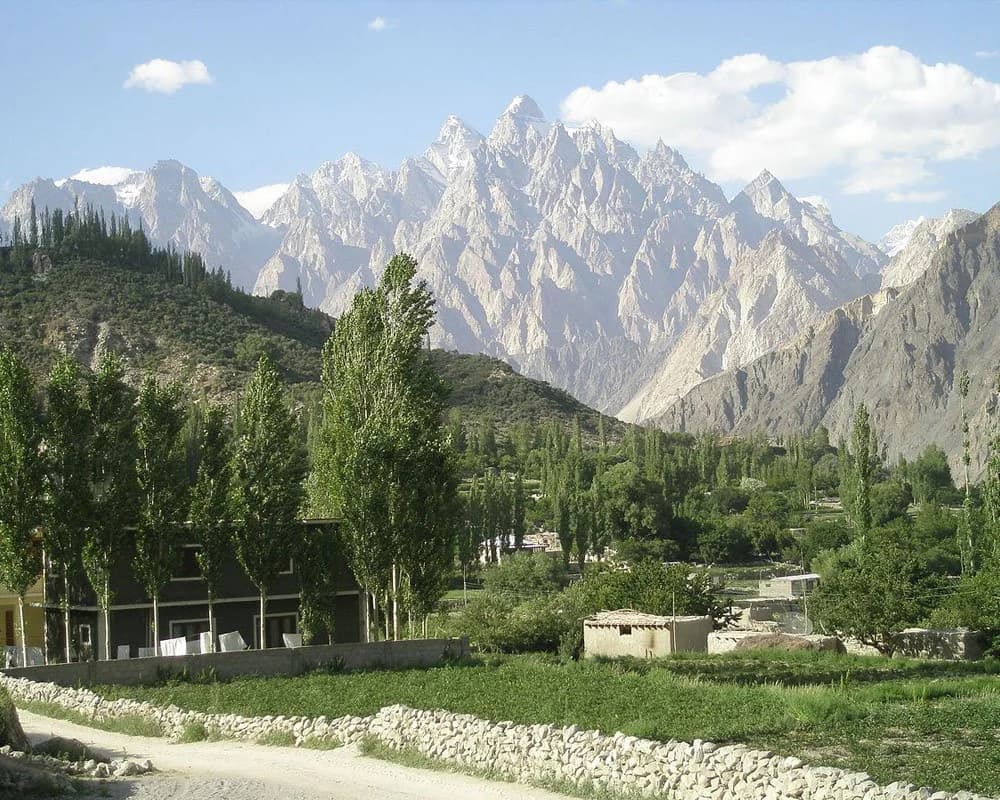
The saw-toothed ridge above Passu village is Tupopdan (6,106 m), though almost nobody calls it that: on postcards and Instagram it is the Passu Cones. Passu is 20 km past Gulmit, about 75 minutes from Karimabad. For the classic photo, pull over on the highway just before the village while the morning sun is on the spires.
 17
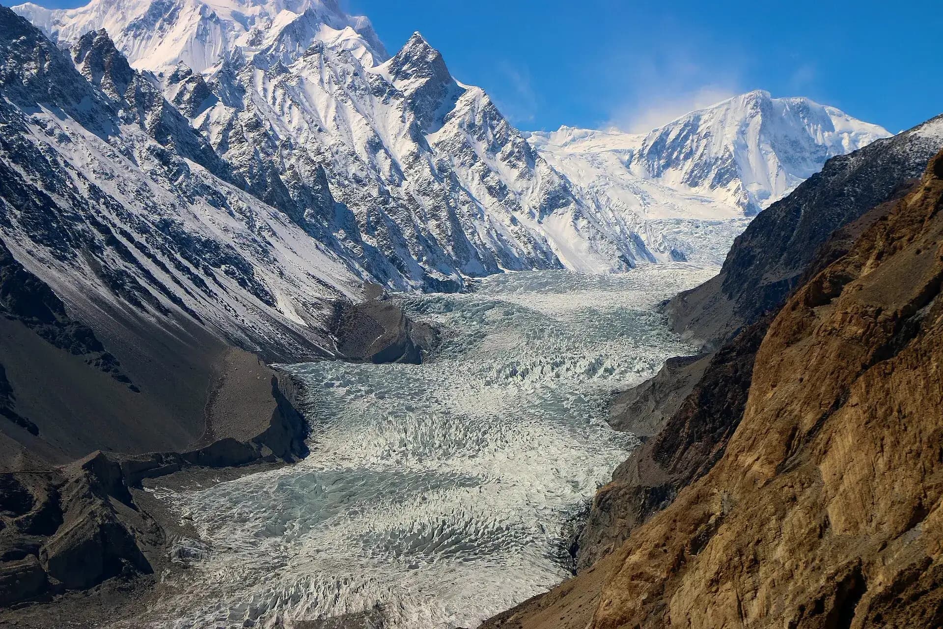
Passu and Batura glaciers
Passu is known as the home of glaciers. The Passu Glacier lies on the south side of the village and can be seen from the highway on the way to Khunjerab. It is easy to reach with your own car, and even on a short trip there is time to walk from the road to the ice for some moments of cold breeze.
The Batura Glacier, just north of the Passu massif, is about 57 km long, one of the longest glaciers outside the polar regions, and its snout reaches almost to the highway. On its flanks there are meadows with wild alpine flowers, birch, wild rose and juniper. Seeing more than the snout means a trek of a few days.
 18
Sost
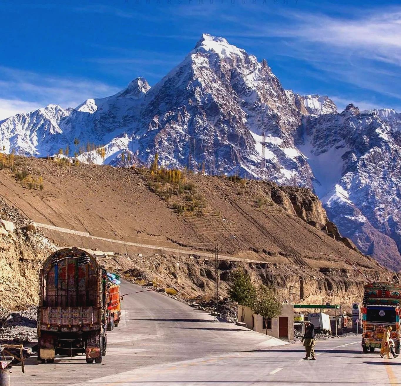
Sost is the last town before the border, with the Pakistani customs post and the dry port where Chinese trucks unload. Nobody comes for the view. You stop for fuel, tea and a meal, because there is little else for the 75 km up to the pass. The road into the Chapursan valley also starts here.
 19
Khunjerab Pass and Khunjerab National Park
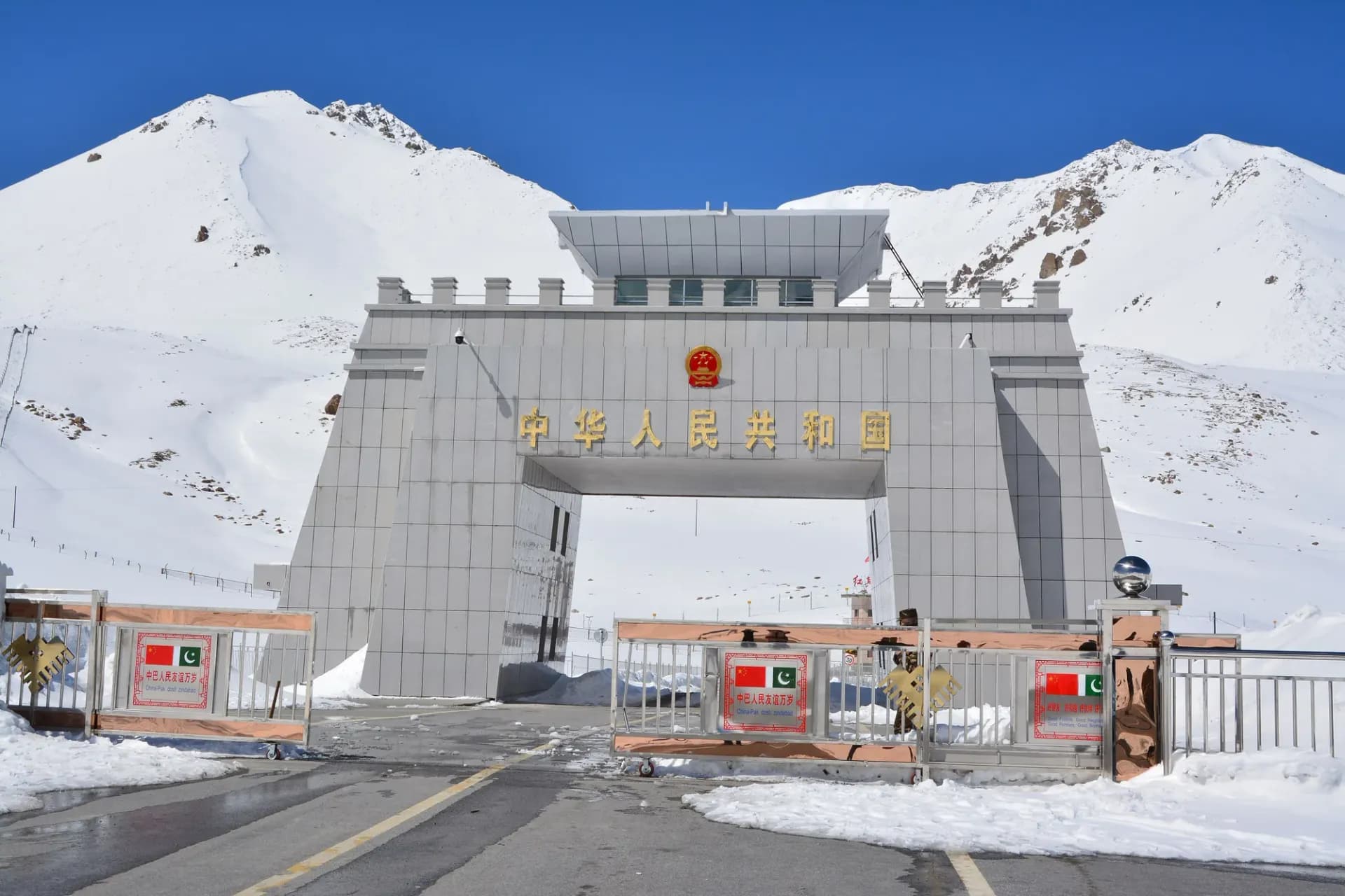
The Khunjerab Pass is the border with China's Xinjiang region, at 4,693 m (15,397 ft), the highest paved international border crossing anywhere. The road over it opened in 1982. From Karimabad it is roughly 170 km, three to four hours each way, through Sost and then Khunjerab National Park, which you pay to enter at the Dih checkpost: in 2026 about PKR 500 per person for Pakistanis, about PKR 100 for Gilgit-Baltistan residents, and a reported USD 40 for most foreigners. In December 2024 Pakistan announced that the crossing would stay open for trade all year, closed at weekends, but for tourists it is still a May to October trip, and snow can shut it on any day.
There is little to buy at the top, so bring snacks, water and warm jackets, even in July. The old advice was to eat apricots on the way for the lack of oxygen; they will not help. You go from about 2,500 m to 4,693 m in a few hours, so walk slowly at the top, take your photos and start down within half an hour. Do not photograph the soldiers or the border post without asking.
The national park was set up in 1975 to protect the Marco Polo sheep, named after the traveller, with their large spiralling horns. The 2012 count found only 41, all of them animals that had crossed over from China. On the drive you are far more likely to see ibex, blue sheep and marmots.
 20
Shimshal and Chapursan (extra days)
Two side valleys of Gojal need extra days. Shimshal is up a long, narrow jeep road east of Passu, and its village is the start of the Shimshal Pass and Shimshal Pamir treks. Chapursan runs west from Sost towards the Afghan border, with Wakhi villages and the shrine of Baba Ghundi at its head. Phone signal is poor or absent in both and guest houses are simple, so go with a local driver who knows the road.
Peaks you can see from Hunza
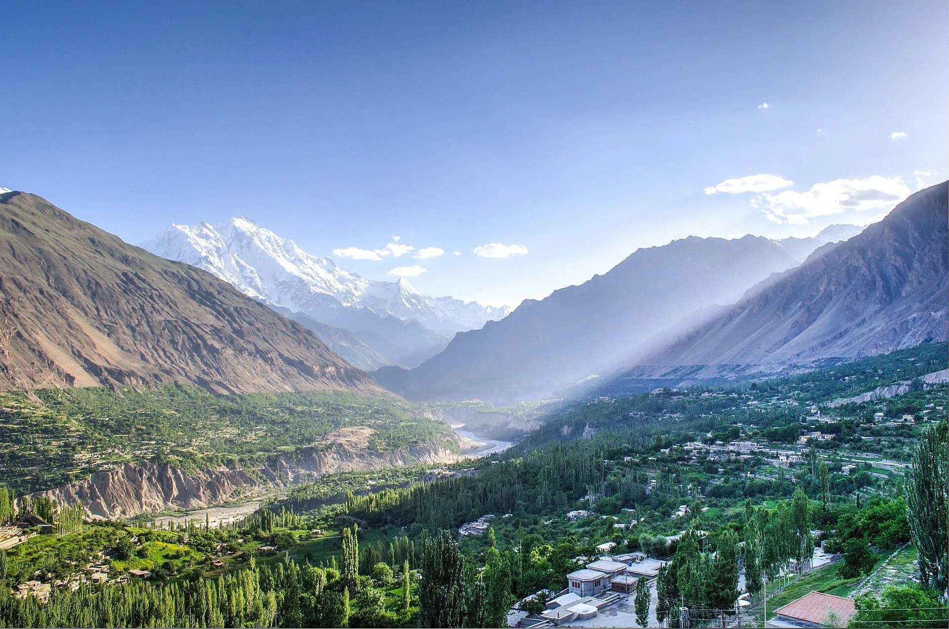
You do not have to trek to see big Karakoram peaks in Hunza. From a hotel roof in Karimabad you can see three of these, and the drive to Passu adds the rest.
- Rakaposhi (7,788 m), the white wall south of Karimabad, 27th highest in the world. Best from Ghulmet and Eagle's Nest.
- Diran (7,266 m), the rounded snow dome east of Rakaposhi, above the Minapin glacier. Climbers know it for storms and avalanches.
- Ladyfinger Peak, or Bublimotin, about 6,000 m: a thin rock needle on the ridge of Ultar Sar. Snow does not stick to it, which is why it stands out grey among the white peaks.
- Ultar Sar (7,388 m), the massif right behind Baltit Fort. Ladyfinger sits on its ridge.
- Tupopdan (6,106 m), the Passu Cones, above Passu village.
Glaciers of Hunza and Nagar
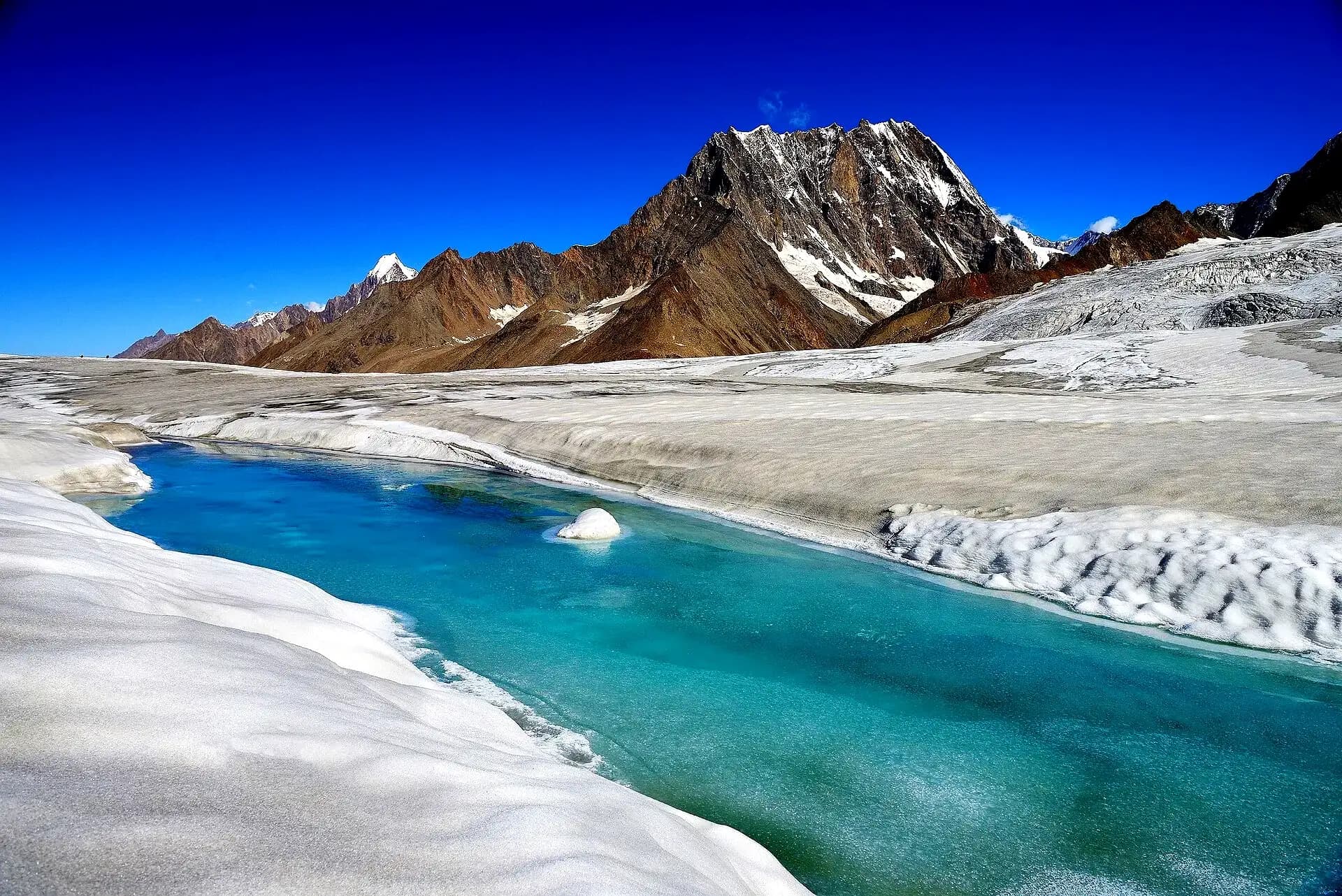
Hopar, Passu and the snout of the Batura can be seen from a car. The two big glaciers on the Nagar side cannot.
The Hispar Glacier, 49 km long, fills the top of the Hispar valley, a jeep ride beyond Nagar Khas. At its head, over the Hispar La pass, it meets the Biafo Glacier (67 km), which flows the other way into Baltistan. Old guides, including our own, used to say the Biafo was a few hours from Hunza. It is not: Hispar and Biafo together make a traverse of about 100 km over 12 to 14 days, the Snow Lake trek.
Hunza culture, people and festivals
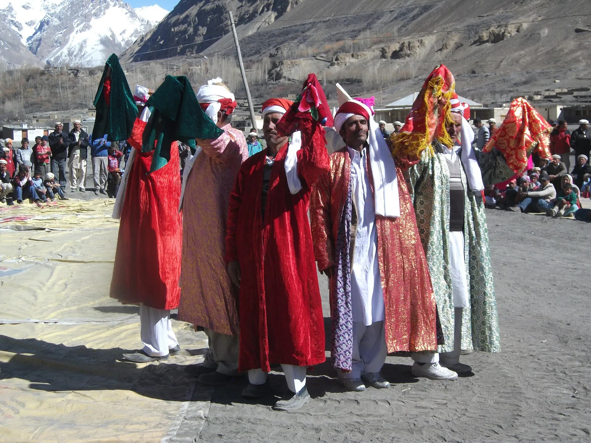
Peace is the identity of the Hunza people. The villagers are very friendly and eager to help, and they will make you feel at home. That is a big part of why thousands of tourists come back every year.
Burushaski is spoken in central Hunza and Nagar, Wakhi in Gojal and Shina lower down, and almost everyone speaks Urdu. Hunza is known in Pakistan for its schools: literacy is widely reported above 90 percent. You may also hear that Hunza people live longer than anyone else. That story came mostly from the old rulers, and there is no real evidence for it. Hunza was a princely state under its Mirs until 1974.
The main celebrations are Nauroz on 21 March, Ginani, the harvest festival, around 21 June, and the Salgirah of the Aga Khan. The Ginani gatherings are biggest at Altit, Aliabad and Baltit Fort. On these days families cook traditional dishes such as harissa and sharbat, and there are cultural shows and sports. The blossom season in early April brings exhibitions and programmes of its own.
Fruits and food of Hunza
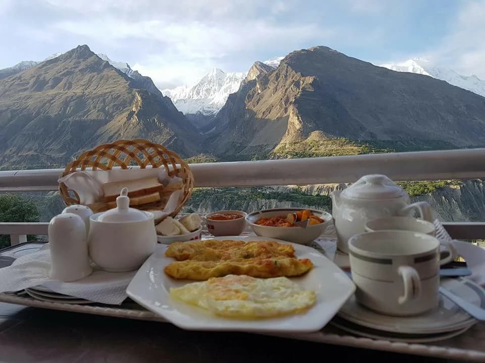
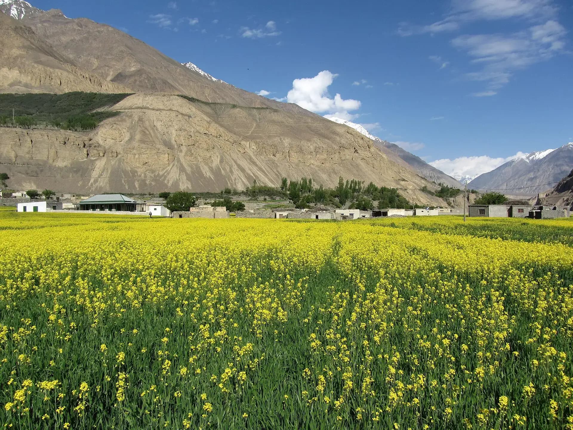
The Hunza people built their own irrigation channels and terraced fields, and their fruit is the best in the north. Apricots, cherries, apples, peaches, plums, mulberries, grapes and pears all grow here. When we talk about Hunza fruit we cannot forget the apricot: in the old days dried apricots were the main winter food, and families still dry them on the rooftops every summer. People also grow maize, wheat, peas and vegetables.
The cuisine of Gilgit-Baltistan is as distinct as it is unique. Look for these on cafe menus:
Chapshuro
flat bread filled with minced meat, the local favourite.
Mamtu
steamed meat dumplings.
Harissa
wheat cooked slowly with meat until smooth, for festivals and winter.
Diram fitti
bread made from sprouted wheat flour, eaten with apricot oil or butter.
Gooli and chupati
the everyday breads.
Sharbat
a thick sweet made with apricot oil and flour.
Walnut cake and apricot juice
sold in almost every cafe in Karimabad.
Distances and times from Karimabad
| Place | Distance | One way by car from Karimabad |
|---|---|---|
| Baltit Fort | In town | 10 minute walk |
| Altit Fort | About 3 km | 10 minutes |
| Eagle's Nest (Duikar) | About 6 km | 20 to 30 minutes |
| Aliabad | About 7 km | 10 minutes |
| Hopar Glacier | Across the river | About 1 hour |
| Rakaposhi View Point (Ghulmet) | South on the highway | About 1 hour |
| Attabad Lake | About 14 km | 30 to 40 minutes |
| Gulmit | Past Attabad Lake | About 1 hour |
| Hussaini bridge and Borith Lake | Just past Gulmit | Just over 1 hour |
| Passu | 20 km past Gulmit | About 75 minutes |
| Khunjerab Pass | About 170 km | 3 to 4 hours |
Best time to visit Hunza
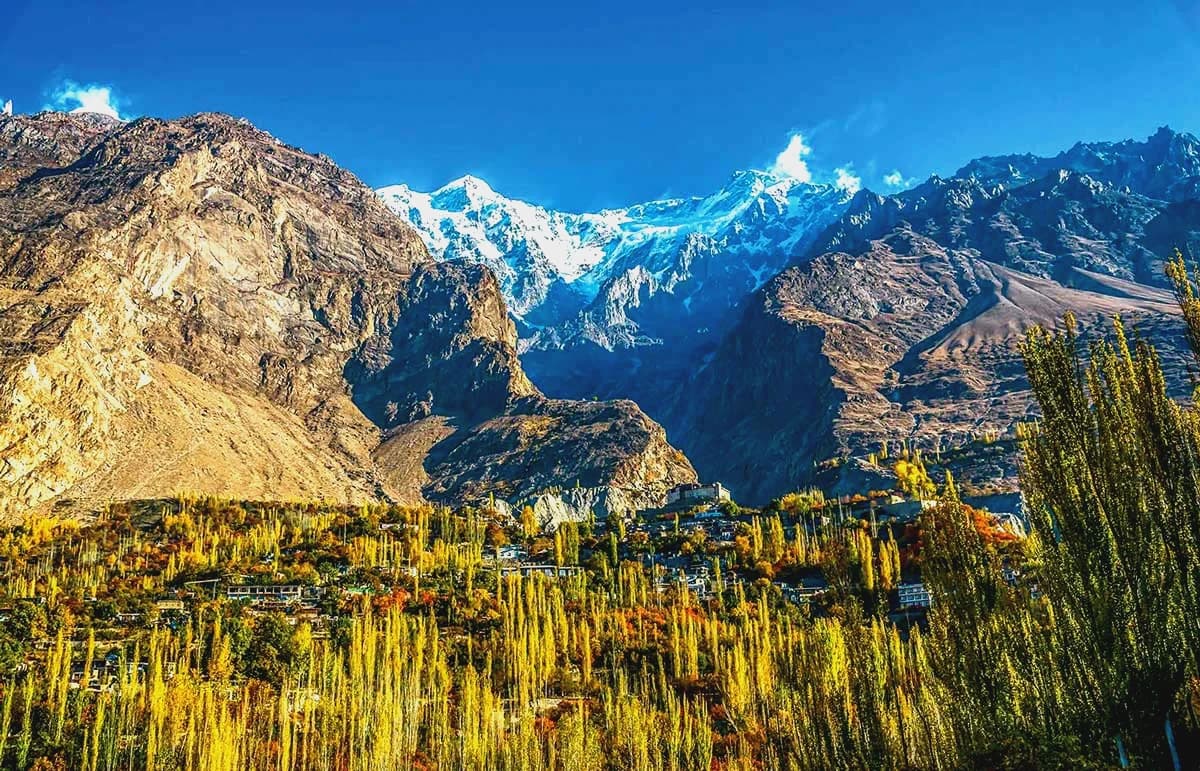
Most people come between April and October. The month you pick decides what you see, and in autumn it also decides the road, because Babusar Top usually closes in October or November.
| Months | What you get |
|---|---|
| Early to mid April | Apricot and cherry blossom, cool days, few crowds |
| May and June | Green fields, long days, Khunjerab open, Ginani in June |
| July and August | Warmest and busiest, every road open; monsoon cloudbursts can cut the Babusar and Karakoram Highway roads for days |
| September | Clear skies, harvest, fewer visitors |
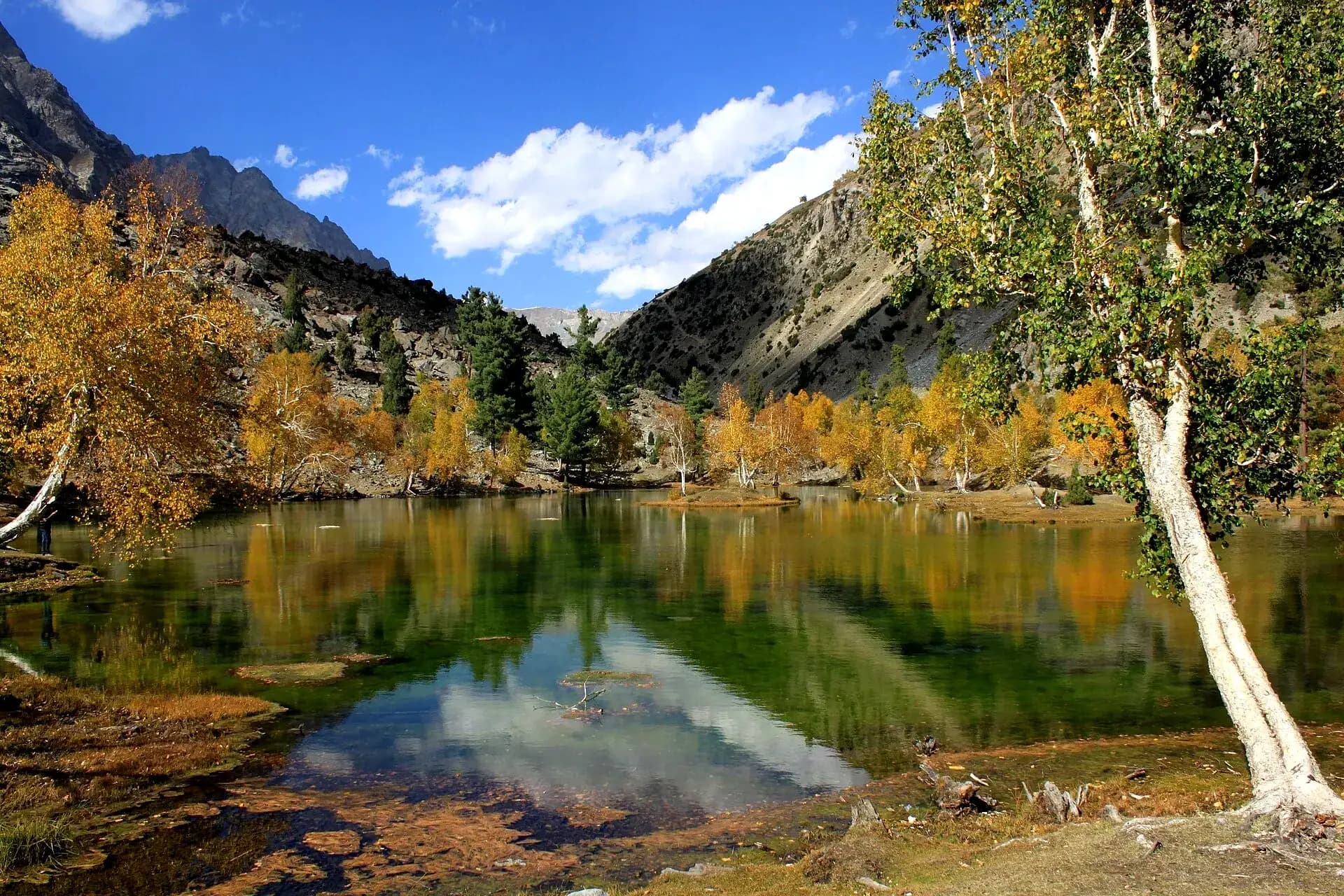
| October to early November | Yellow poplars and red orchards, cold nights |
| December to March | Snow, freezing nights, power cuts; Khunjerab closed to tourists |
How to reach Hunza from Lahore and Islamabad
Karimabad is about 930 km from Lahore by road, two long days with a night on the way. From roughly June to October, Babusar Top is open and the quicker route is via Naran, over the pass to Chilas and up the Karakoram Highway through Gilgit. The rest of the year you stay on the Karakoram Highway the whole way, through Besham and Dasu, which is slower but never shuts for the season. Islamabad to Karimabad alone is a 12 to 14 hour drive.
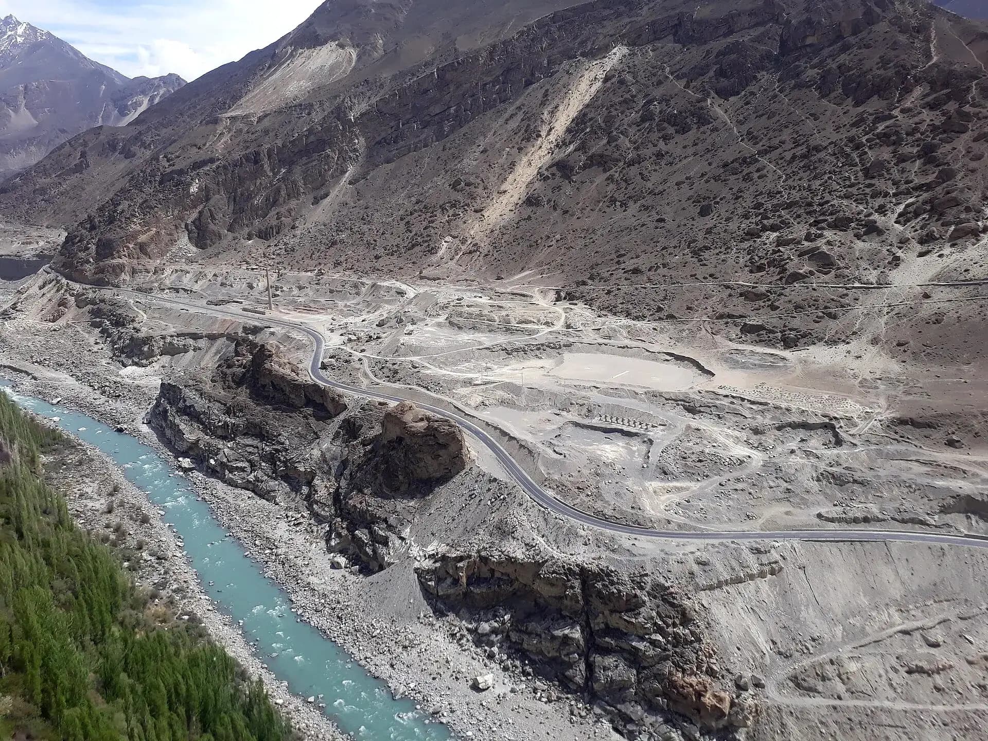
The Karakoram Highway is called the eighth wonder of the world. It follows the old Silk Road from Hasan Abdal through Mansehra, Thakot, Besham, Pattan, Chilas, Gilgit and Hunza, over the Khunjerab Pass and on to Kashgar in China. In Hunza it runs beside the Hunza River, which rises near the Chinese border and joins the Gilgit River below Gilgit.
Flights from Islamabad to Gilgit take about an hour, then two hours by road to Karimabad, but they are often cancelled in bad weather. Our Hunza tour packages go by road from Lahore with one night in Naran on the way.
How many days do you need in Hunza?
These are days in Hunza itself. From Lahore, add two days on the road each way.
1 day
Karimabad, Baltit Fort, Altit Fort and Eagle's Nest at sunset.
2 days
add Attabad Lake, Hussaini bridge, Passu and the Khunjerab Pass.
3 days
add the Hopar Glacier, Ganish and the Rakaposhi viewpoint at an easy pace.
4 days or more
a night in Gulmit or Passu, Borith Lake, the Ultar Meadows walk, or Shimshal.
Before you go: signal, cash, altitude and tickets
In the 2026 PTA survey for Gilgit-Baltistan, SCOM came first for coverage and speed, with Zong close behind. Jazz, Ufone and Telenor also work in the towns, only slower. Between villages, in Shimshal and at Khunjerab the signal goes, so download offline maps before you leave Karimabad.
Aliabad, Karimabad and Gilgit have ATMs, but they are few and can run dry on a busy weekend. Draw cash before you head north, where you will pay in cash for boats, the bridge, the park fee and food.
Karimabad is at about 2,500 m, the height at which altitude sickness can start, and Khunjerab is 4,693 m. A headache and a poor first night are common. Drink plenty of water, skip alcohol, and keep the first day easy. If the headache or sickness gets worse, go down.
Baltit Fort (about PKR 1,000), Altit Fort (about PKR 1,600) and Ganish each sell tickets with a guide included, the Hussaini bridge has a small toll and the Khunjerab park fee (about PKR 500 for Pakistanis) is paid at Dih. There are three rates almost everywhere: lowest for locals from Gilgit-Baltistan, then other Pakistanis, then foreigners. The amounts go up most seasons, so keep small notes handy.
For a base, pick Karimabad for the forts and the bazaar, Aliabad or the Nagar side for Rakaposhi from your window, and Gulmit or Passu for a quiet night near the glaciers. Rooms fill up in July, August and on autumn weekends.
Frequently asked questions
What are the top 10 places to visit in Hunza?
Karimabad, Baltit Fort, Altit Fort, Eagle's Nest, the Rakaposhi View Point, Attabad Lake, the Hussaini Suspension Bridge, Passu Cones, Borith Lake and the Khunjerab Pass. With an extra day, add the Hopar Glacier and Gulmit.
What is the best time to visit Hunza Valley?
April to October. Early April for blossom, May to September for green fields and the Khunjerab Pass, and late October for autumn colour. Winter is very cold and the pass is closed to tourists.
How many days are enough for Hunza?
Two full days in Hunza cover Karimabad, the forts, Attabad Lake, Passu and Khunjerab. From Lahore, add two days each way for the road, so 5 to 6 days in total, like our Hunza tour packages.
How far is Hunza from Lahore and Islamabad?
By road, Karimabad is about 930 km from Lahore, which takes two days, and about 575 km from Islamabad, a 12 to 14 hour drive. From Gilgit airport it is about 100 km, around two hours.
Is the Khunjerab Pass open for tourists?
Plan it for May to October. Since December 2024 Pakistan has said the crossing stays open all year for trade, Monday to Friday, but winter snow and cold make it no trip for visitors, and even in summer a snowfall can close the road for a day. Carry your CNIC or passport for the Dih checkpost.
Show 5 more questions
Can you visit Hunza in winter?
Yes, by the Karakoram Highway through Besham, which stays open, though landslides can close it for a while. Babusar Top is shut, Khunjerab is off limits to tourists, nights are well below freezing and power cuts are common. Many hotels and cafes close, so book ahead and ask about heating.
What is the difference between Hunza and Nagar?
They are sister valleys on opposite banks of the Hunza River, once two separate states. Karimabad, the forts and upper Hunza are on the Hunza side; the Rakaposhi viewpoint, Hopar Glacier and Rush Lake are in Nagar.
Do mobile phones work in Hunza?
In the towns, yes: Karimabad, Aliabad, Gulmit and Passu all have mobile data. A SCOM or Zong SIM is the safest choice. Expect no signal on parts of the highway, in Shimshal and at the pass.
What food is Hunza famous for?
Chapshuro, a flat bread stuffed with minced meat, is the one everyone orders. After that come mamtu dumplings, harissa, diram fitti, and walnut cake with apricot juice. Dried apricots and walnuts from the bazaar are the usual thing to take home.
Is Hunza safe for families?
Yes. Hunza is one of the calmest parts of Pakistan, and families from all over the country holiday here. What can go wrong is the road and the weather: landslides after rain, and the cold and thin air at Khunjerab for small children and older parents.